Approximate Location Map
Large Map »
Latitude: 56.0033 / 56°0'12"N
Longitude: -2.5172 / 2°31'2"W
OS Eastings: 367840
OS Northings: 679053
OS Grid: NT678790
Mapcode National: GBR ND4V.9KH
Mapcode Global: WH8W0.9CKM
Plus Code: 9C8V2F3M+84
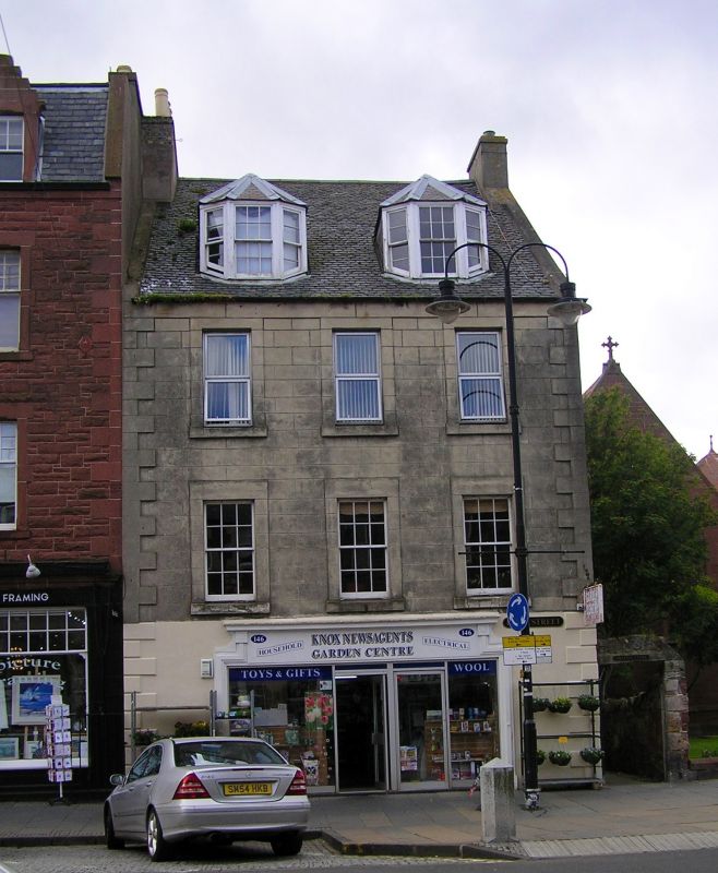
Entry Name: 146, 148 High Street, Dunbar
Listing Name: 146 and 148 High Street
Listing Date: 11 January 1988
Category: C
Source: Historic Scotland
Source ID: 360912
Historic Scotland Designation Reference: LB24827
Building Class: Cultural
ID on this website: 200360912
Location: Dunbar
County: East Lothian
Town: Dunbar
Electoral Ward: Dunbar and East Linton
Traditional County: East Lothian
Tagged with: Architectural structure
Late 18th century. 3-storey and attic, 3-bay house. Rendered
and lined as ashlar; painted ground floor and N gable, raised
margins and quoins, rusticated at ground floor. Late 19th
century shop front at ground. Plate glass sashes with
interior shutters and altered windows. Slate roof; attic
dormers added 1899.
Effective full-stop to W High Street range.
External links are from the relevant listing authority and, where applicable, Wikidata. Wikidata IDs may be related buildings as well as this specific building. If you want to add or update a link, you will need to do so by editing the Wikidata entry.


Other nearby listed buildings
