Approximate Location Map
Large Map »
Latitude: 56.0032 / 56°0'11"N
Longitude: -2.5171 / 2°31'1"W
OS Eastings: 367848
OS Northings: 679035
OS Grid: NT678790
Mapcode National: GBR ND4V.HKK
Mapcode Global: WH8W0.9CMR
Plus Code: 9C8V2F3M+75
Entry Name: 140 High Street, 138, Dunbar
Listing Name: 136 and 138 High Street
Listing Date: 11 January 1988
Category: C
Source: Historic Scotland
Source ID: 360911
Historic Scotland Designation Reference: LB24826
Building Class: Cultural
ID on this website: 200360911
Location: Dunbar
County: East Lothian
Town: Dunbar
Electoral Ward: Dunbar and East Linton
Traditional County: East Lothian
Tagged with: Architectural structure Office building
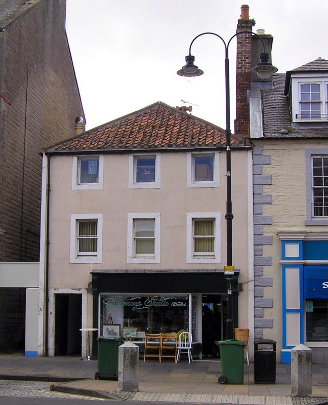
Mid 18th century. 3-storey, 3-bay tenement. Rendered with
plain painted margins. Altered late 19th century shop front
at ground. Plate glass sash windows 1st, single pane modern
pivot at 2nd. Pantiled piended roof, ridge tiles; slate
easing course.
Diminutive version of No 126-8 of group of 3, 3-storey
piended tenements, NW quarter of High Street.
External links are from the relevant listing authority and, where applicable, Wikidata. Wikidata IDs may be related buildings as well as this specific building. If you want to add or update a link, you will need to do so by editing the Wikidata entry.


Other nearby listed buildings
