Approximate Location Map
Large Map »
Latitude: 56.4584 / 56°27'30"N
Longitude: -2.9755 / 2°58'31"W
OS Eastings: 339982
OS Northings: 730005
OS Grid: NO399300
Mapcode National: GBR Z99.C6
Mapcode Global: WH7RB.8XCT
Plus Code: 9C8VF25F+8R
Entry Name: 27, 29 Tay Street Lane, Dundee
Listing Name: 15-29 (Odd Nos) Tay Street Lane
Listing Date: 30 March 1995
Category: C
Source: Historic Scotland
Source ID: 361897
Historic Scotland Designation Reference: LB25572
Building Class: Cultural
ID on this website: 200361897
Location: Dundee
County: Dundee
Town: Dundee
Electoral Ward: West End
Traditional County: Angus
Tagged with: Mews
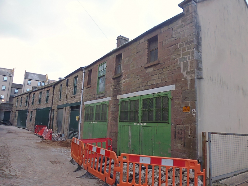
David Neave, earlier 19th century. Row of 2-storey mews buildings. Rubble sandstone, slate roof. Sliding and 2-leaf garage doors to ground floor, windows of various design to 1st floor.
These mews buildings pertain to the east side of South Tay Street, laid out in 1792 and built 1819-29. Although altered, the buildings are important for their relation to South Tay Street. Nos 9-13 were demolished 1994.
External links are from the relevant listing authority and, where applicable, Wikidata. Wikidata IDs may be related buildings as well as this specific building. If you want to add or update a link, you will need to do so by editing the Wikidata entry.


Other nearby listed buildings
