Approximate Location Map
Large Map »
Latitude: 55.0704 / 55°4'13"N
Longitude: -3.6121 / 3°36'43"W
OS Eastings: 297156
OS Northings: 576287
OS Grid: NX971762
Mapcode National: GBR 396T.S6
Mapcode Global: WH5WJ.HT5C
Plus Code: 9C7R39CQ+45
Entry Name: 12, 14 Church Crescent, Dumfries
Listing Name: 8, 10, 12, 14 Church Crescent
Listing Date: 6 March 1981
Category: C
Source: Historic Scotland
Source ID: 362639
Historic Scotland Designation Reference: LB26131
Building Class: Cultural
ID on this website: 200362639
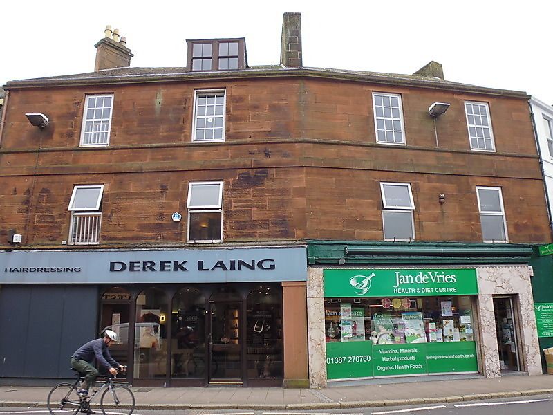
Circa 1830. 2 blocks, 2 + 2 bays set at angle following
curve of street. 3 storeys with attics, shops at ground
with fascias reaching 1st floor cill course. Droved red
ashlar. Sash windows, plate glass at 1st floor, 12-pane
glazing pattern at 2nd floor. Band course between
upper floors, string at 2nd floor cill level. Single
bipartite dormer. End stacks; slate roof.
External links are from the relevant listing authority and, where applicable, Wikidata. Wikidata IDs may be related buildings as well as this specific building. If you want to add or update a link, you will need to do so by editing the Wikidata entry.


Other nearby listed buildings
