Approximate Location Map
Large Map »
Latitude: 55.0679 / 55°4'4"N
Longitude: -3.6101 / 3°36'36"W
OS Eastings: 297280
OS Northings: 576013
OS Grid: NX972760
Mapcode National: GBR 397V.72
Mapcode Global: WH5WJ.JW47
Plus Code: 9C7R399Q+5X
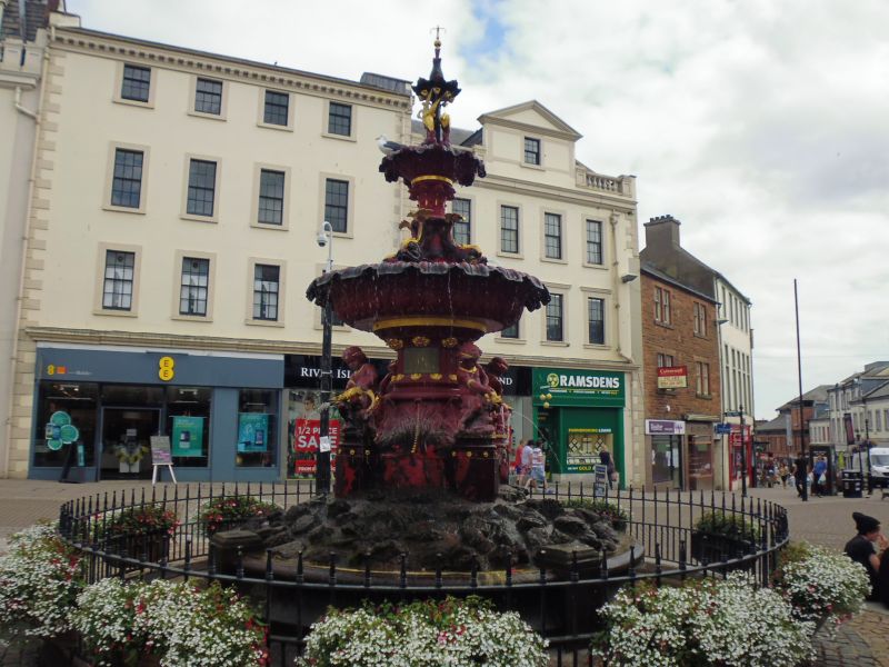
Entry Name: Fountain, High Street, Dumfries
Listing Name: High Street, Fountain
Listing Date: 6 March 1981
Category: B
Source: Historic Scotland
Source ID: 362751
Historic Scotland Designation Reference: LB26214
Building Class: Cultural
Also known as: Dumfries, High Street, Fountain
ID on this website: 200362751
Location: Dumfries
County: Dumfries and Galloway
Electoral Ward: Nith
Traditional County: Dumfriesshire
Tagged with: Fountain
External links are from the relevant listing authority and, where applicable, Wikidata. Wikidata IDs may be related buildings as well as this specific building. If you want to add or update a link, you will need to do so by editing the Wikidata entry.


Other nearby listed buildings
