Approximate Location Map
Large Map »
Latitude: 55.9579 / 55°57'28"N
Longitude: -3.1487 / 3°8'55"W
OS Eastings: 328376
OS Northings: 674470
OS Grid: NT283744
Mapcode National: GBR 8YC.PR
Mapcode Global: WH6SM.LHTY
Plus Code: 9C7RXV52+5G
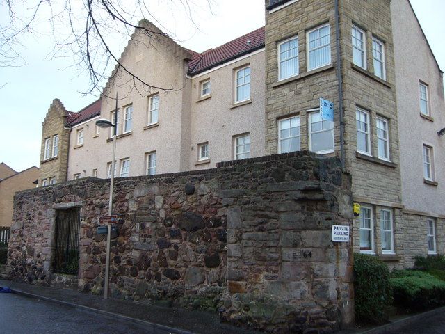
Entry Name: Deanery Wall, Restalrig Road South, Edinburgh
Listing Name: Restalrig Road South, Deanery Wall, Between Nos 62A and 64
Listing Date: 14 December 1970
Category: B
Source: Historic Scotland
Source ID: 364357
Historic Scotland Designation Reference: LB27258
Building Class: Cultural
ID on this website: 200364357
Location: Edinburgh
County: Edinburgh
Town: Edinburgh
Electoral Ward: Craigentinny/Duddingston
Traditional County: Midlothian
Tagged with: Architectural structure
Probably 16th century in origin. Rubble stone outer wall of Deanery of Restalrig. Entrance to right with large splayed piers corbelled at top. Window to centre blocked with rubble stone, large wide doorway to left blocked with squared stone.
The Deanery is no longer extant.
External links are from the relevant listing authority and, where applicable, Wikidata. Wikidata IDs may be related buildings as well as this specific building. If you want to add or update a link, you will need to do so by editing the Wikidata entry.


Other nearby listed buildings
