Approximate Location Map
Large Map »
Latitude: 55.9606 / 55°57'38"N
Longitude: -3.1955 / 3°11'43"W
OS Eastings: 325463
OS Northings: 674825
OS Grid: NT254748
Mapcode National: GBR 8NB.7R
Mapcode Global: WH6SL.WFJV
Plus Code: 9C7RXR63+7R
Entry Name: Scotland Street Tunnel, Edinburgh
Listing Name: Scotland Street Tunnel Royal Crescent, Foot of Scotland Street
Listing Date: 25 November 1965
Category: B
Source: Historic Scotland
Source ID: 365324
Historic Scotland Designation Reference: LB27953
Building Class: Cultural
Also known as: Edinburgh, Scotland Street Tunnel
ID on this website: 200365324
Location: Edinburgh
County: Edinburgh
Town: Edinburgh
Electoral Ward: City Centre
Traditional County: Midlothian
Tagged with: Railway tunnel
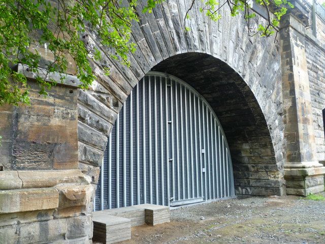
Grainger & Miller, engineers. Opened May 17th, 1847. Closed
22nd May, 1868. Northern exit arch, now blocked semi-circular
with long voussoirs.
Edinburgh Leith and Newhaven Railway. Similar tunnel at N end
of Goods Yard dates from 1841.
External links are from the relevant listing authority and, where applicable, Wikidata. Wikidata IDs may be related buildings as well as this specific building. If you want to add or update a link, you will need to do so by editing the Wikidata entry.


Other nearby listed buildings
