Approximate Location Map
Large Map »
Latitude: 55.9234 / 55°55'24"N
Longitude: -3.2496 / 3°14'58"W
OS Eastings: 322009
OS Northings: 670738
OS Grid: NT220707
Mapcode National: GBR 89S.83
Mapcode Global: WH6SS.1CVX
Plus Code: 9C7RWQF2+95
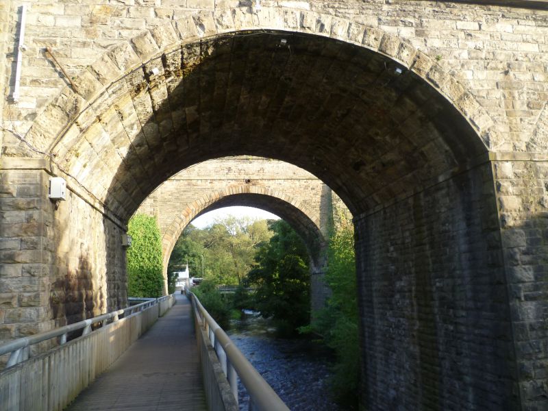
Entry Name: Slateford Aqueduct, Union Canal, Edinburgh
Listing Name: Union Canal Slateford Aqueduct over Inglis Green Road and Water of Leith.
Listing Date: 14 December 1970
Category: B
Source: Historic Scotland
Source ID: 365330
Historic Scotland Designation Reference: LB27958
Building Class: Cultural
Also known as: Edinburgh, Union Canal, Slateford Aqueduct
ID on this website: 200365330
Location: Edinburgh
County: Edinburgh
Town: Edinburgh
Electoral Ward: Fountainbridge/Craiglockhart
Traditional County: Midlothian
Tagged with: Aqueduct Bridge Navigable aqueduct
Hugh Baird, engineer, 1818-22. Eight arches carrying canal, block-in-course masonry with railed parapet.
Scheduled Monument
External links are from the relevant listing authority and, where applicable, Wikidata. Wikidata IDs may be related buildings as well as this specific building. If you want to add or update a link, you will need to do so by editing the Wikidata entry.


Other nearby listed buildings
