Approximate Location Map
Large Map »
Latitude: 55.9432 / 55°56'35"N
Longitude: -3.184 / 3°11'2"W
OS Eastings: 326148
OS Northings: 672876
OS Grid: NT261728
Mapcode National: GBR 8QK.K0
Mapcode Global: WH6SM.2W36
Plus Code: 9C7RWRV8+7C
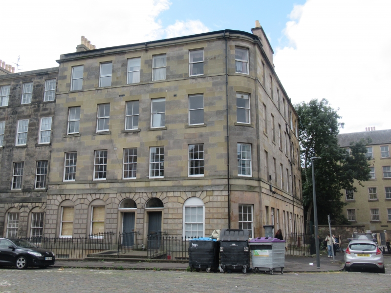
Entry Name: 35, 37, 39 St Patrick Square, Edinburgh
Listing Name: St Patrick Square 35-41
Listing Date: 14 December 1970
Category: B
Source: Historic Scotland
Source ID: 370109
Historic Scotland Designation Reference: LB29738
Building Class: Cultural
Also known as: Edinburgh, 35, 37, 39 St Patrick Square
ID on this website: 200370109
Location: Edinburgh
County: Edinburgh
Town: Edinburgh
Electoral Ward: Southside/Newington
Traditional County: Midlothian
Tagged with: Tenement
Circa 1800. 4-storey and basement, rusticated ground floor.
External links are from the relevant listing authority and, where applicable, Wikidata. Wikidata IDs may be related buildings as well as this specific building. If you want to add or update a link, you will need to do so by editing the Wikidata entry.


Other nearby listed buildings
