Latitude: 56.1903 / 56°11'25"N
Longitude: -2.8185 / 2°49'6"W
OS Eastings: 349297
OS Northings: 700043
OS Grid: NO492000
Mapcode National: GBR 2Q.FW69
Mapcode Global: WH7SR.PN1T
Plus Code: 9C8V55RJ+4H
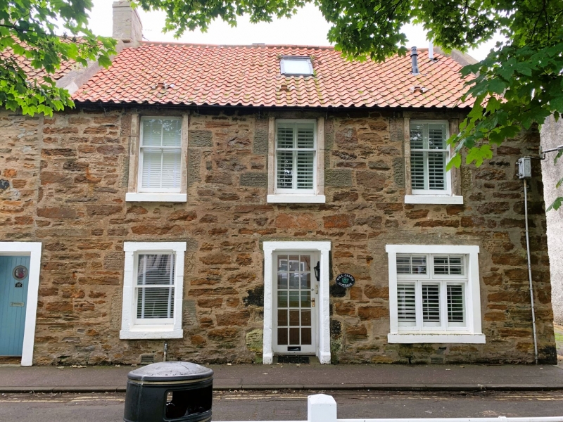
Entry Name: 34 High Street, Elie
Listing Name: Elie 32 34 High Street (Red Cottage)
Listing Date: 8 January 1980
Category: C
Source: Historic Scotland
Source ID: 372145
Historic Scotland Designation Reference: LB30970
Building Class: Cultural
ID on this website: 200372145
Location: Elie and Earlsferry
County: Fife
Town: Elie And Earlsferry
Electoral Ward: East Neuk and Landward
Traditional County: Fife
Tagged with: Architectural structure
Circa 1800. Originally 2-storey 3-window, later extended east wards to
4 with single-storey wing, rubble with margins, later stop chamfers
2 ground floor windows altered; pantiled, modern brick chimney, crowstepped at back; single-storey wing slated.
External links are from the relevant listing authority and, where applicable, Wikidata. Wikidata IDs may be related buildings as well as this specific building. If you want to add or update a link, you will need to do so by editing the Wikidata entry.


Other nearby listed buildings