Latitude: 56.192 / 56°11'31"N
Longitude: -2.8221 / 2°49'19"W
OS Eastings: 349076
OS Northings: 700234
OS Grid: NO490002
Mapcode National: GBR 2Q.FV6Z
Mapcode Global: WH7SR.MMBH
Plus Code: 9C8V55RH+Q4
Entry Name: Elmbank, 41 Park Place, Elie
Listing Name: Elie Elmbank 41 Park Place
Listing Date: 8 January 1980
Category: C
Source: Historic Scotland
Source ID: 372176
Historic Scotland Designation Reference: LB30990
Building Class: Cultural
ID on this website: 200372176
Location: Elie and Earlsferry
County: Fife
Town: Elie And Earlsferry
Electoral Ward: East Neuk and Landward
Traditional County: Fife
Tagged with: House
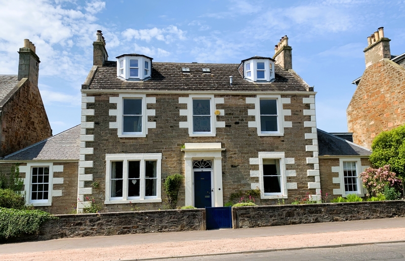
Early 19th century. 2-storey 3-window, main block, single-storey piend roofed 1-window wings; coursed rubble with painted margins and droved dressings, raised quoins, artisan pilastered fanlight doorpiece, one ground floor tripartite, reglazed. Slated, skew ends have sunk roundels.
External links are from the relevant listing authority and, where applicable, Wikidata. Wikidata IDs may be related buildings as well as this specific building. If you want to add or update a link, you will need to do so by editing the Wikidata entry.


Other nearby listed buildings