Approximate Location Map
Large Map »
Latitude: 56.1879 / 56°11'16"N
Longitude: -2.8361 / 2°50'9"W
OS Eastings: 348205
OS Northings: 699787
OS Grid: NT482997
Mapcode National: GBR 2P.G4SV
Mapcode Global: WH7SR.DQQN
Plus Code: 9C8V55Q7+5H
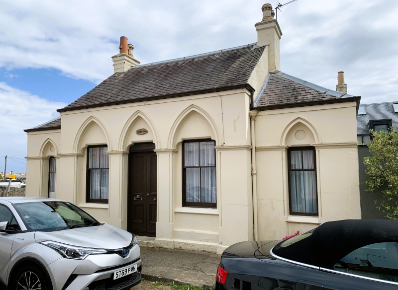
Entry Name: Turret Lodge, 67 High Street, Earlsferry
Listing Name: Earlsferry, Turret Lodge, 67 High Street
Listing Date: 18 August 1972
Category: B
Source: Historic Scotland
Source ID: 372258
Historic Scotland Designation Reference: LB31066
Building Class: Cultural
Also known as: Earlsferry, 67 High Street, Turret Lodge
ID on this website: 200372258
Location: Elie and Earlsferry
County: Fife
Town: Elie And Earlsferry
Electoral Ward: East Neuk and Landward
Traditional County: Fife
Tagged with: Architectural structure
19th century. Gothic, small symmetrical single-storey, 2-window and centre door with 1-window set-back wings, shouldered lintels within arched heads; painted stucco and slate.
External links are from the relevant listing authority and, where applicable, Wikidata. Wikidata IDs may be related buildings as well as this specific building. If you want to add or update a link, you will need to do so by editing the Wikidata entry.


Other nearby listed buildings
