Approximate Location Map
Large Map »
Latitude: 56.1882 / 56°11'17"N
Longitude: -2.836 / 2°50'9"W
OS Eastings: 348213
OS Northings: 699819
OS Grid: NT482998
Mapcode National: GBR 2P.G4SR
Mapcode Global: WH7SR.DQSF
Plus Code: 9C8V55Q7+7J
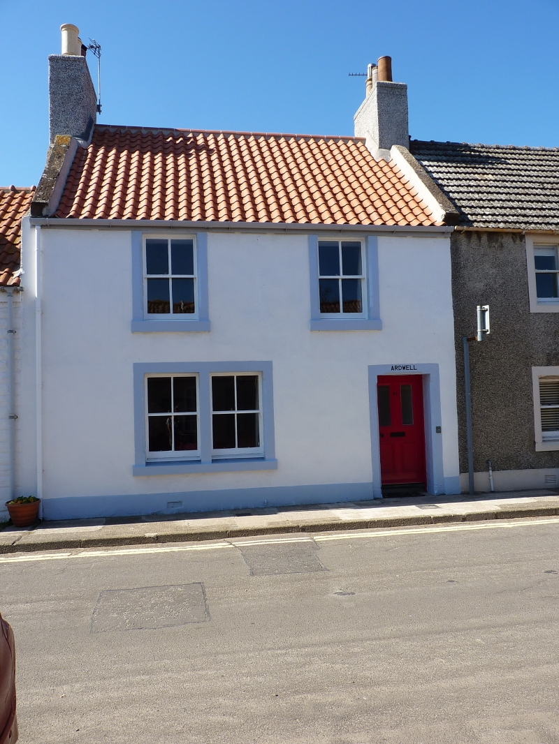
Entry Name: Ardwell, High Street, Earlsferry
Listing Name: Ardwell High Street
Listing Date: 18 August 1972
Category: C
Source: Historic Scotland
Source ID: 372277
Historic Scotland Designation Reference: LB31085
Building Class: Cultural
Also known as: Earlsferry, High Street, Ardwell
ID on this website: 200372277
Location: Elie and Earlsferry
County: Fife
Town: Elie And Earlsferry
Electoral Ward: East Neuk and Landward
Traditional County: Fife
Tagged with: Architectural structure
Late 18th century. 2-storey 2-window at 1st painted stucco
with painted margins, later Victorian stop-chamfers,
pantiled; altered fenestration at ground floor, modern
bipartite.
External links are from the relevant listing authority and, where applicable, Wikidata. Wikidata IDs may be related buildings as well as this specific building. If you want to add or update a link, you will need to do so by editing the Wikidata entry.


Other nearby listed buildings
