Latitude: 57.6126 / 57°36'45"N
Longitude: -3.6073 / 3°36'26"W
OS Eastings: 304070
OS Northings: 859201
OS Grid: NJ040592
Mapcode National: GBR K8GL.VNR
Mapcode Global: WH5H4.KXGJ
Plus Code: 9C9RJ97V+23
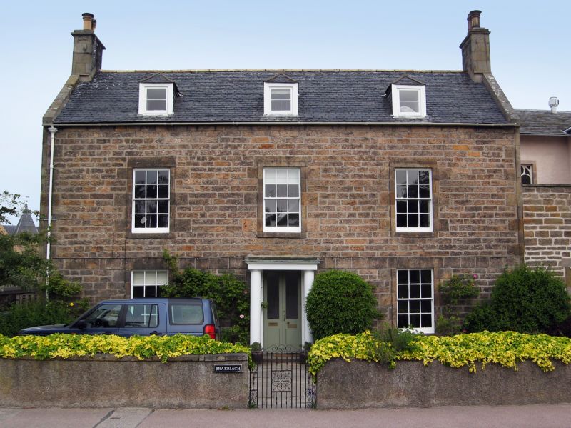
Entry Name: Braeriach, Victoria Road, Forres
Listing Name: Victoria Road, Braeriach
Listing Date: 26 January 1971
Category: B
Source: Historic Scotland
Source ID: 373091
Historic Scotland Designation Reference: LB31768
Building Class: Cultural
Also known as: Forres, Victoria Road, Braeriach
ID on this website: 200373091
Location: Forres
County: Moray
Town: Forres
Electoral Ward: Forres
Traditional County: Morayshire
Tagged with: House
Circa 1800. 2-storey and attic, 3-bay house with centre door;
coursed rubble random rubble to gables and rear, ashlar
dressings. Simple wooden Doric columned porch; band course
linking lintels of ground floor windows; raised margins; 12-pane
sashes; 3 small piended dormers. End stacks with angle
margins; slate roof. Low coped and harled front garden wall.
Appears on Wood's map of 1823.
Former Item 153 (1983 Revised List)
External links are from the relevant listing authority and, where applicable, Wikidata. Wikidata IDs may be related buildings as well as this specific building. If you want to add or update a link, you will need to do so by editing the Wikidata entry.


Other nearby listed buildings