Latitude: 55.8358 / 55°50'8"N
Longitude: -4.2654 / 4°15'55"W
OS Eastings: 258223
OS Northings: 662607
OS Grid: NS582626
Mapcode National: GBR 0JW.FR
Mapcode Global: WH3P8.GL31
Plus Code: 9C7QRPPM+8V
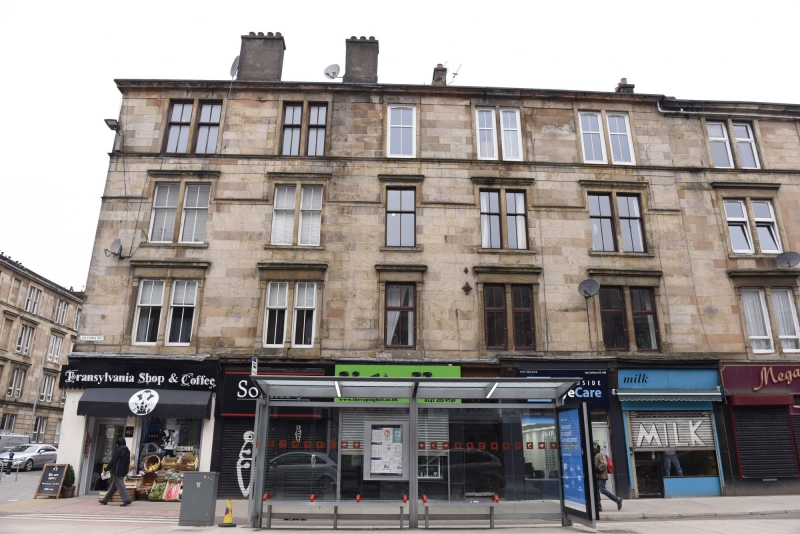
Entry Name: 452, 454, 456, 458, 460, 462 Victoria Road, Glasgow
Listing Name: 452-462 (Even Nos) Victoria Road/Prince Edward Street
Listing Date: 5 December 1989
Category: C
Source: Historic Scotland
Source ID: 374676
Historic Scotland Designation Reference: LB32465
Building Class: Cultural
ID on this website: 200374676
The tenement forms part of a larger block that was originally known as Eglinton Terrace, which occupies the west side of Victoria Road, from Allison Street to Prince Edward Street. The 2-acre site was feud to a William Menzies in 1863, (Title deed for 3/1 404 Victoria Road, 2023) and by 1864 it was being advertised as having 'superior houses of three and four rooms and kitchens' to let (Glasgow Herald, 11 April 1864), with shops advertised by 1865 (Glasgow Herald, 6 February 1865). First listed in the Glasgow Street Directory of 1866, the block was known as Eglinton Terrace until 1877-78 when it was renumbered as part of Victoria Road, and there was further renumbering in 1890-91 (Glasgow Street Directories 1869-1893).
The corresponding corner block to the north at 400, 404, 408 Victoria Road and 124 Allison Street is also listed (category B, ref: LB32464) and forms part of the block formerly known as Eglinton Terrace.
Supplementary information added to the listed building record in 2024.
External links are from the relevant listing authority and, where applicable, Wikidata. Wikidata IDs may be related buildings as well as this specific building. If you want to add or update a link, you will need to do so by editing the Wikidata entry.


Other nearby listed buildings