Approximate Location Map
Large Map »
Latitude: 56.2226 / 56°13'21"N
Longitude: -2.705 / 2°42'17"W
OS Eastings: 356383
OS Northings: 703563
OS Grid: NO563035
Mapcode National: GBR 2V.CXY9
Mapcode Global: WH7SM.FV4J
Plus Code: 9C8V67FW+22
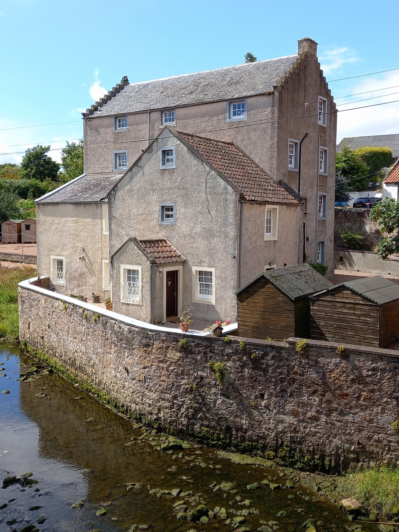
Entry Name: Dreel Burn Mill, Anstruther Easter
Listing Name: Old Corn Mill on Dreel Burn, off High Street Anstruther Easter
Listing Date: 9 May 1972
Category: B
Source: Historic Scotland
Source ID: 380805
Historic Scotland Designation Reference: LB36093
Building Class: Cultural
Also known as: Anstruther Easter, Dreel Burn Mill
ID on this website: 200380805
Location: Kilrenny
County: Fife
Town: Kilrenny
Electoral Ward: East Neuk and Landward
Traditional County: Fife
Tagged with: Mill building
1702 and later (top floor is mid 19th century) 3-storey rubble main building, crowstepped and slated, lower pantiled kiln and outbuildings.
External links are from the relevant listing authority and, where applicable, Wikidata. Wikidata IDs may be related buildings as well as this specific building. If you want to add or update a link, you will need to do so by editing the Wikidata entry.


Other nearby listed buildings
