Approximate Location Map
Large Map »
Latitude: 58.9846 / 58°59'4"N
Longitude: -2.956 / 2°57'21"W
OS Eastings: 345149
OS Northings: 1011218
OS Grid: HY451112
Mapcode National: GBR M42Z.LKQ
Mapcode Global: WH7C4.KFLP
Plus Code: 9CCVX2MV+RH
Entry Name: 14 St Catherine's Place, Kirkwall
Listing Name: 13 and 14 St Catherine's Place
Listing Date: 8 December 1971
Category: B
Source: Historic Scotland
Source ID: 381656
Historic Scotland Designation Reference: LB36796
Building Class: Cultural
Also known as: Kirkwall, 14 St Catherine's Place
ID on this website: 200381656
Location: Kirkwall
County: Orkney Islands
Town: Kirkwall
Electoral Ward: Kirkwall East
Traditional County: Orkney
Tagged with: Terrace house
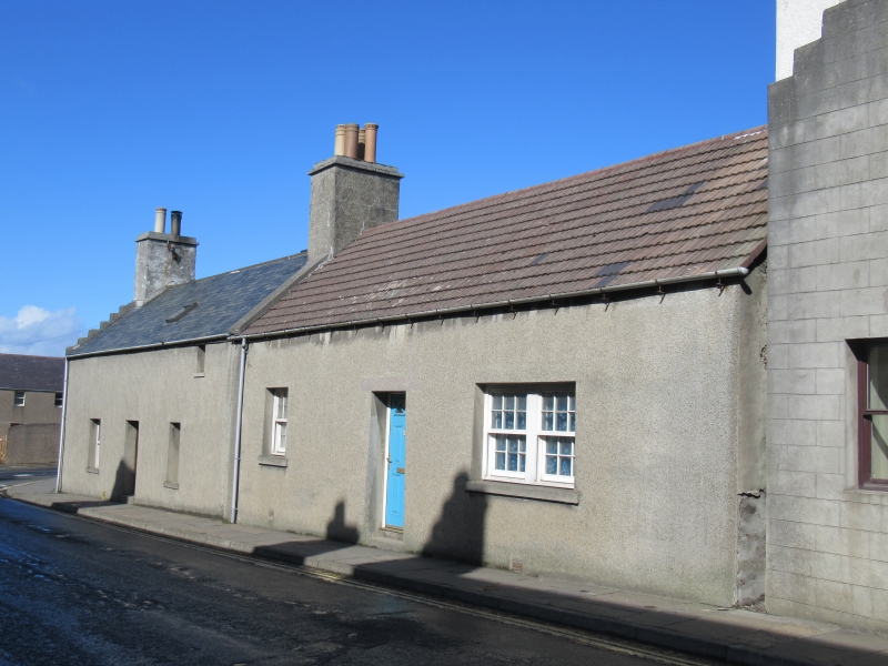
Circa 1805 with later alterations. Single storey and attic, pair of 3-bay houses forming small terrace, with crowstepped gable to N (Number 12), abutting Number 15 St Catherine's Place (listed separately) to S. Harled.
W (PRINCIPAL) ELEVATIONS: NUMBER 13 (to N): deep-set part-glazed modern door in bay to centre; window in each bay flanking; small attic window set wide to outer right. NUMBER 14 (to S): deep-set modern timber door in bay to centre. Window in bay to left. Enlarged window in bay to right.
N (SIDE) ELEVATION, (NUMBER 13): 2-bay. Window at each floor in bay to right; attic window in bay to left; gablehead stack above.
2-pane timber-framed windows with top hung upper lights to Number 13; central rooflight; 12-pane timber sash and case windows to Number 14. Modern grey slate to Number 13; concrete tiles to Number 14; stone ridges; stone central skews; harled, corniced gablehead and ridge stacks; uPVC rainwater goods.
INTERIORS: not seen, 1998.
B-Group with Numbers 9 to 12, 15 to 18, 19 and 20, 21 and 22, 23 and 24, 25 and 26 St Catherine's Plcace and 1 to 9 Cromwell Road. This pair of houses forms part of a small development on the eastern side of St Catherine's Place, constructed as workers' houses by a farmer, Andrew Drever, in the early part of the 19th century. Rows of houses (listed separately) stand in the traditional manner with their gabled ends to the street with flagstoned closes between. Collectively they form a surviving group of some quality. Numbers 13 and 14 have distinctive substantial stacks, tall in proportion, and Number 13 retains its crowstepped gable. The wide gap between the windows and the eaves to Number 13 is typical of high class town houses in both Orkney and Shetland, and is less common in smaller, single storey dwellings.
External links are from the relevant listing authority and, where applicable, Wikidata. Wikidata IDs may be related buildings as well as this specific building. If you want to add or update a link, you will need to do so by editing the Wikidata entry.


Other nearby listed buildings
