Approximate Location Map
Large Map »
Latitude: 55.6741 / 55°40'26"N
Longitude: -3.7822 / 3°46'56"W
OS Eastings: 288013
OS Northings: 643724
OS Grid: NS880437
Mapcode National: GBR 220T.YV
Mapcode Global: WH5SJ.WN31
Plus Code: 9C7RM6F9+J4
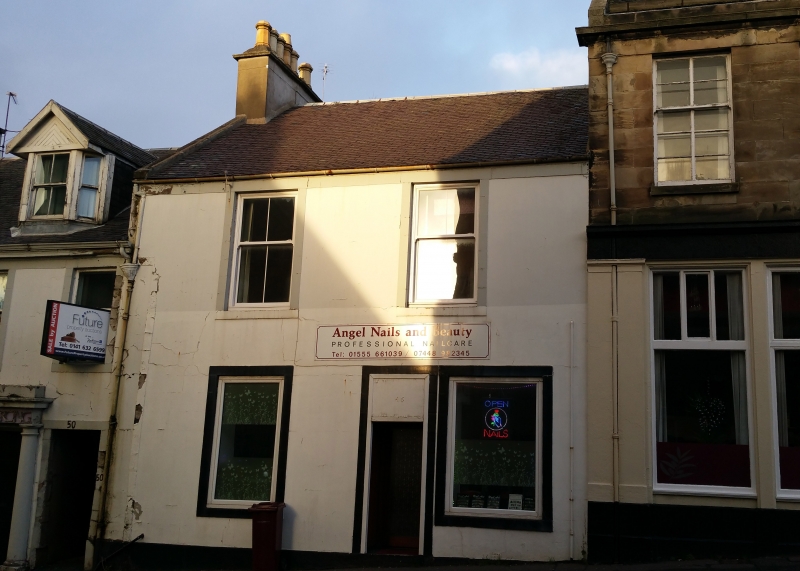
Entry Name: 48 Bloomgate, Lanark
Listing Name: 48 Bloomgate
Listing Date: 7 May 1980
Category: C
Source: Historic Scotland
Source ID: 381852
Historic Scotland Designation Reference: LB36945
Building Class: Cultural
ID on this website: 200381852
Location: Lanark
County: South Lanarkshire
Town: Lanark
Electoral Ward: Clydesdale North
Traditional County: Lanarkshire
Tagged with: Architectural structure
Mid 19th century. 2 storeys, 2 windows. Black painted
stucco lined to imitate ashlar jointing. Off-centre door
with 2 flanking shop windows to ground. Eaves course.
Straight skews, corniced stacks, slate roof.
External links are from the relevant listing authority and, where applicable, Wikidata. Wikidata IDs may be related buildings as well as this specific building. If you want to add or update a link, you will need to do so by editing the Wikidata entry.


Other nearby listed buildings
