Latitude: 55.6741 / 55°40'26"N
Longitude: -3.7823 / 3°46'56"W
OS Eastings: 288006
OS Northings: 643730
OS Grid: NS880437
Mapcode National: GBR 220T.XT
Mapcode Global: WH5SJ.WN20
Plus Code: 9C7RM6F9+J3
Entry Name: 50-52 Bloomgate, Lanark
Listing Name: 52 Bloomgate
Listing Date: 7 May 1980
Category: B
Source: Historic Scotland
Source ID: 381853
Historic Scotland Designation Reference: LB36946
Building Class: Cultural
Also known as: Lanark, 50-52 Bloomgate
ID on this website: 200381853
Location: Lanark
County: South Lanarkshire
Town: Lanark
Electoral Ward: Clydesdale North
Traditional County: Lanarkshire
Tagged with: Architectural structure
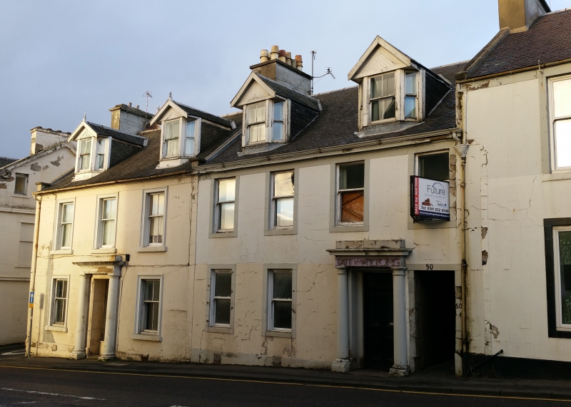
Early 19th century. 2 storeys and attic, 4 windows. Stucco
with painted margins. Doorpiece with engaged Roman Doric
columns in right centre bay. Pend in right bay. Eaves
course and cornice. 2 later canted gabled dormers. 1
stack. Slate roof.
External links are from the relevant listing authority and, where applicable, Wikidata. Wikidata IDs may be related buildings as well as this specific building. If you want to add or update a link, you will need to do so by editing the Wikidata entry.


Other nearby listed buildings