Approximate Location Map
Large Map »
Latitude: 57.5859 / 57°35'9"N
Longitude: -3.8661 / 3°51'57"W
OS Eastings: 288531
OS Northings: 856626
OS Grid: NH885566
Mapcode National: GBR J8TN.XG1
Mapcode Global: WH4G2.LL7G
Plus Code: 9C9RH4PM+8H
Entry Name: 125 High Street, Nairn
Listing Name: 125 and 117 High Street
Listing Date: 12 March 1981
Category: C
Source: Historic Scotland
Source ID: 383794
Historic Scotland Designation Reference: LB38432
Building Class: Cultural
ID on this website: 200383794
Location: Nairn
County: Highland
Town: Nairn
Electoral Ward: Nairn and Cawdor
Traditional County: Nairnshire
Tagged with: Architectural structure
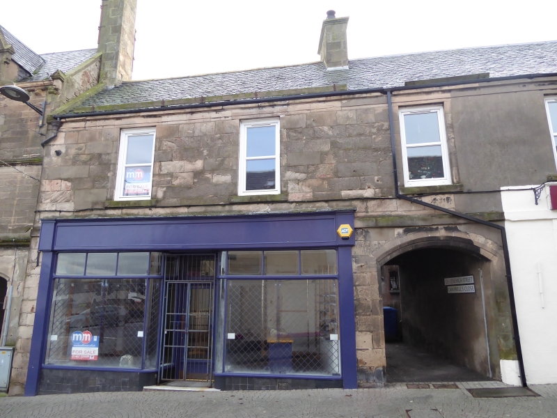
Early 19th century, 2 storey, 5 bays. Ground floor with
centre segmental arched pend and flanking shops; band course
between ground and 1st floors remains in part; 4 1st floor
windows. Coursed rubble. Early shop front to No 117
(Morrison's Bakery). Eaves band and cornice; corniced end and
ridge stacks; slate roof.
External links are from the relevant listing authority and, where applicable, Wikidata. Wikidata IDs may be related buildings as well as this specific building. If you want to add or update a link, you will need to do so by editing the Wikidata entry.


Other nearby listed buildings
