Latitude: 55.8474 / 55°50'50"N
Longitude: -4.4244 / 4°25'27"W
OS Eastings: 248310
OS Northings: 664230
OS Grid: NS483642
Mapcode National: GBR 3K.4P90
Mapcode Global: WH3P6.09F5
Plus Code: 9C7QRHWG+W6
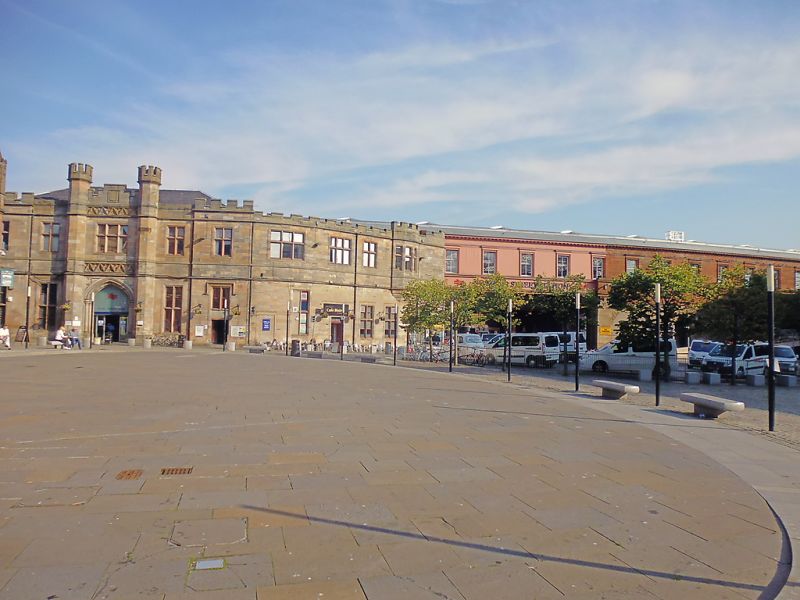
Entry Name: Railway Station, Gilmour Street, Paisley
Listing Name: County Square, Gilmour Street Railway Station
Listing Date: 27 March 1985
Category: B
Source: Historic Scotland
Source ID: 384438
Historic Scotland Designation Reference: LB38950
Building Class: Cultural
Also known as: Paisley, Gilmour Street, Railway Station
PYG
ID on this website: 200384438
Location: Paisley
County: Renfrewshire
Town: Paisley
Electoral Ward: Paisley East and Central
Traditional County: Renfrewshire
Tagged with: Railway station
The later 19th century, two storey, red ashlar north elevation (Old Sneddon Street) is made up of 19 bays to the west of the bridge, four (timber) bays over Sneddon Street, and eight bays to the east of the bridge. There is a large ornate arched entrance four bays west of the bridge with paired squared pilasters with and corniced curved entablature over. Various shops to ground floor.
There are three different sized arches to each side of Gilmour Street under the iron girder bridge structure.
The original part of the station was built in 1840 as a five-bay symmetrical, rectangular plan and is shown on the first edition map (surveyed 1858, published 1864). It currently forms the western side of the south elevation and it was built for the Glasgow and Paisley Joint Railway. The station was extended in 1866-8 by Blyth and Cunningham and the works included adding the eastern part of the south elevation and extending beyond the bridge. In the 1880s, two tracks were added to the north and the entire red sandstone north elevation was constructed to support them. The original width of the tracks are defined by the width of the earlier three arches evident under the bridge on Sneddon Street.
The small curved stones that fill in the re-entrant angle at the southeast corner of the bridge are thought to be the remains of a 'urine deflector' built to discourage public urination.
External links are from the relevant listing authority and, where applicable, Wikidata. Wikidata IDs may be related buildings as well as this specific building. If you want to add or update a link, you will need to do so by editing the Wikidata entry.


Other nearby listed buildings