Latitude: 56.2127 / 56°12'45"N
Longitude: -2.7315 / 2°43'53"W
OS Eastings: 354728
OS Northings: 702472
OS Grid: NO547024
Mapcode National: GBR 2T.DJ9R
Mapcode Global: WH7ST.03LM
Plus Code: 9C8V6779+3C
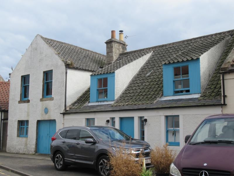
Entry Name: 54 High Street, Pittenweem
Listing Name: 54 High Street House
Listing Date: 18 August 1972
Category: B
Source: Historic Scotland
Source ID: 385813
Historic Scotland Designation Reference: LB39933
Building Class: Cultural
Also known as: Pittenweem, 54 High Street
ID on this website: 200385813
Location: Pittenweem
County: Fife
Town: Pittenweem
Electoral Ward: East Neuk and Landward
Traditional County: Fife
Tagged with: Architectural structure
Early 19th century. Single-storey and attic, 2-window and centre tripartite door, modern dry-dash harl with margins: pantiled with slate skirting, 2 original swept dormers.
External links are from the relevant listing authority and, where applicable, Wikidata. Wikidata IDs may be related buildings as well as this specific building. If you want to add or update a link, you will need to do so by editing the Wikidata entry.


Other nearby listed buildings