Latitude: 55.8857 / 55°53'8"N
Longitude: -4.3834 / 4°23'0"W
OS Eastings: 251022
OS Northings: 668404
OS Grid: NS510684
Mapcode National: GBR 3M.26LQ
Mapcode Global: WH3P0.MBV9
Plus Code: 9C7QVJP8+7J
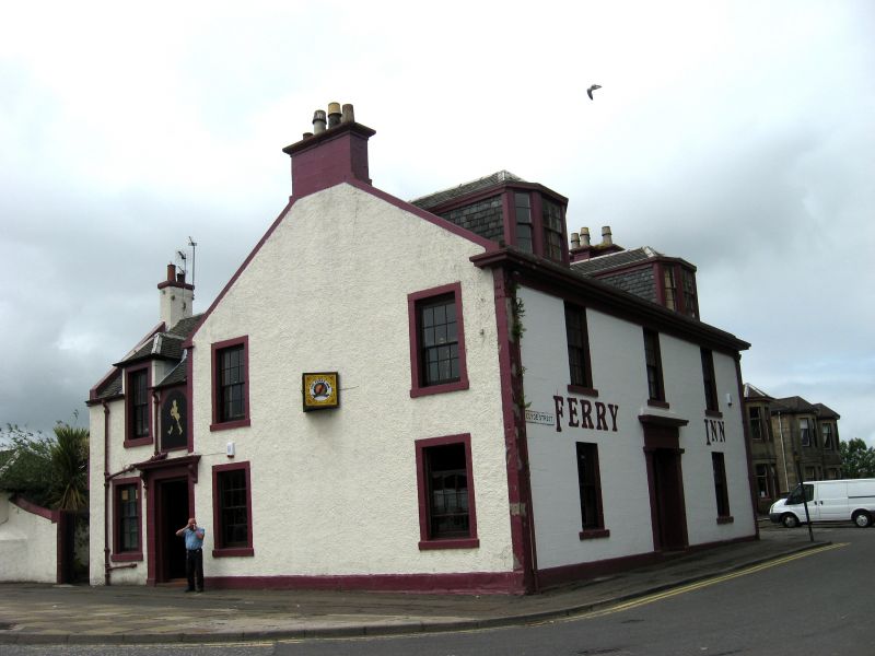
Entry Name: Ferry Inn, Clyde Street, Renfrew
Listing Name: Ferry Inn, Ferry Road & Clyde Street, Renfrew Ferry.
Listing Date: 27 June 1980
Category: C
Source: Historic Scotland
Source ID: 386348
Historic Scotland Designation Reference: LB40419
Building Class: Cultural
ID on this website: 200386348
Location: Renfrew
County: Renfrewshire
Town: Renfrew
Electoral Ward: Renfrew North and Braehead
Traditional County: Renfrewshire
Tagged with: Inn
2-storey with dormered Attic; stone built; slated; plain;
(dated "1829").
External links are from the relevant listing authority and, where applicable, Wikidata. Wikidata IDs may be related buildings as well as this specific building. If you want to add or update a link, you will need to do so by editing the Wikidata entry.


Other nearby listed buildings