Approximate Location Map
Large Map »
Latitude: 56.3398 / 56°20'23"N
Longitude: -2.793 / 2°47'34"W
OS Eastings: 351071
OS Northings: 716660
OS Grid: NO510166
Mapcode National: GBR 2R.4GG0
Mapcode Global: WH7S0.2X77
Plus Code: 9C8V86Q4+WQ
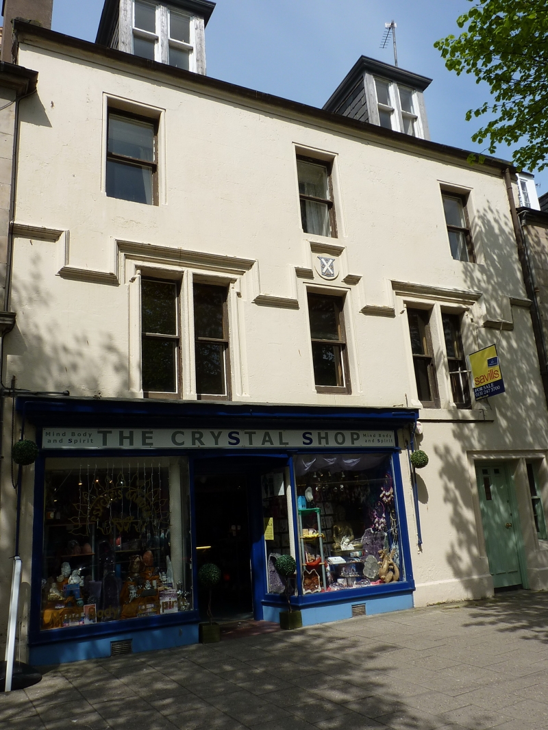
Entry Name: 59, 61 South Street, St Andrews
Listing Name: 59, 61 South Street.
Listing Date: 23 February 1971
Category: B
Source: Historic Scotland
Source ID: 386572
Historic Scotland Designation Reference: LB40620
Building Class: Cultural
Also known as: St Andrews, 59, 61 South Street
ID on this website: 200386572
Remodelled 1866 by George Rae, architect, (for himself).
2-storey and attic, 3-window, ochre washed stucco and slate, string-courses; inset panel inscription on first floor, GR ;
ground floor shop. 1866
External links are from the relevant listing authority and, where applicable, Wikidata. Wikidata IDs may be related buildings as well as this specific building. If you want to add or update a link, you will need to do so by editing the Wikidata entry.


Other nearby listed buildings
