Approximate Location Map
Large Map »
Latitude: 56.3398 / 56°20'23"N
Longitude: -2.7933 / 2°47'35"W
OS Eastings: 351054
OS Northings: 716662
OS Grid: NO510166
Mapcode National: GBR 2R.4GDX
Mapcode Global: WH7S0.2X37
Plus Code: 9C8V86Q4+WM
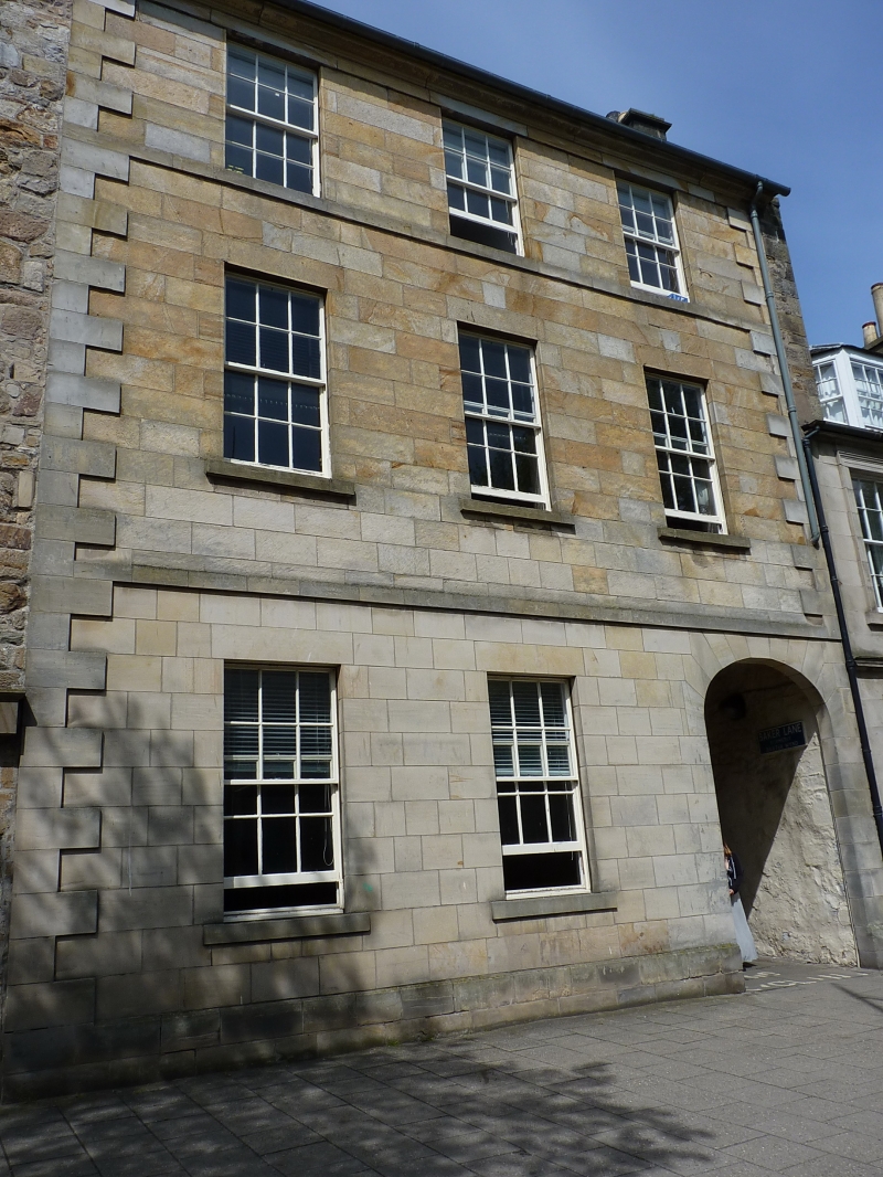
Entry Name: 65 South Street, St Andrews
Listing Name: 65 South Street.
Listing Date: 23 February 1971
Category: B
Source: Historic Scotland
Source ID: 386574
Historic Scotland Designation Reference: LB40622
Building Class: Cultural
Also known as: St Andrews, 65 South Street
ID on this website: 200386574
Location: St Andrews
County: Fife
Town: St Andrews
Electoral Ward: St Andrews
Traditional County: Fife
Tagged with: Architectural structure
C. 1820; 3-storey, 3-window, droved ashlar with raised
quions, slated; ellipetical arched pend through to lane
renovated in original classic style 1974.
External links are from the relevant listing authority and, where applicable, Wikidata. Wikidata IDs may be related buildings as well as this specific building. If you want to add or update a link, you will need to do so by editing the Wikidata entry.


Other nearby listed buildings
