Approximate Location Map
Large Map »
Latitude: 56.3409 / 56°20'27"N
Longitude: -2.791 / 2°47'27"W
OS Eastings: 351196
OS Northings: 716780
OS Grid: NO511167
Mapcode National: GBR 2R.4GWW
Mapcode Global: WH7S0.3W6D
Plus Code: 9C8V86R5+8H
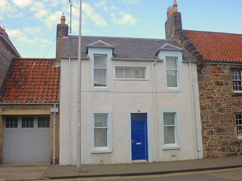
Entry Name: 37 North Street, St Andrews
Listing Name: 37 North Street.
Listing Date: 8 June 1978
Category: C
Source: Historic Scotland
Source ID: 386744
Historic Scotland Designation Reference: LB40764
Building Class: Cultural
ID on this website: 200386744
Location: St Andrews
County: Fife
Town: St Andrews
Electoral Ward: St Andrews
Traditional County: Fife
Tagged with: Architectural structure
Early 19th cent., much altered. 2-storey, 2-window,
semi-dormers; slated.
External links are from the relevant listing authority and, where applicable, Wikidata. Wikidata IDs may be related buildings as well as this specific building. If you want to add or update a link, you will need to do so by editing the Wikidata entry.


Other nearby listed buildings
