Approximate Location Map
Large Map »
Latitude: 56.3392 / 56°20'21"N
Longitude: -2.7915 / 2°47'29"W
OS Eastings: 351169
OS Northings: 716599
OS Grid: NO511165
Mapcode National: GBR 2R.4GT5
Mapcode Global: WH7S0.3X0N
Plus Code: 9C8V86Q5+MC
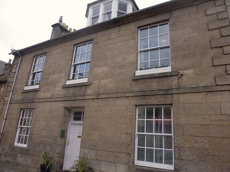
Entry Name: 10 Abbey Street, St Andrews
Listing Name: 10 Abbey Street
Listing Date: 8 June 1978
Category: C
Source: Historic Scotland
Source ID: 386848
Historic Scotland Designation Reference: LB40832
Building Class: Cultural
ID on this website: 200386848
Location: St Andrews
County: Fife
Town: St Andrews
Electoral Ward: St Andrews
Traditional County: Fife
Tagged with: House
Early 19th century. 2-storey and attic, 3-window, ashlar, raised quoins at 1st floor; slated; 1 canted dormer.
Nos 26-28 Abbey Street now demoloshed.
External links are from the relevant listing authority and, where applicable, Wikidata. Wikidata IDs may be related buildings as well as this specific building. If you want to add or update a link, you will need to do so by editing the Wikidata entry.


Other nearby listed buildings
