Approximate Location Map
Large Map »
Latitude: 56.3402 / 56°20'24"N
Longitude: -2.7909 / 2°47'27"W
OS Eastings: 351202
OS Northings: 716710
OS Grid: NO512167
Mapcode National: GBR 2R.4GY6
Mapcode Global: WH7S0.3W7W
Plus Code: 9C8V86R5+3J
Entry Name: 11 South Castle Street, St Andrews
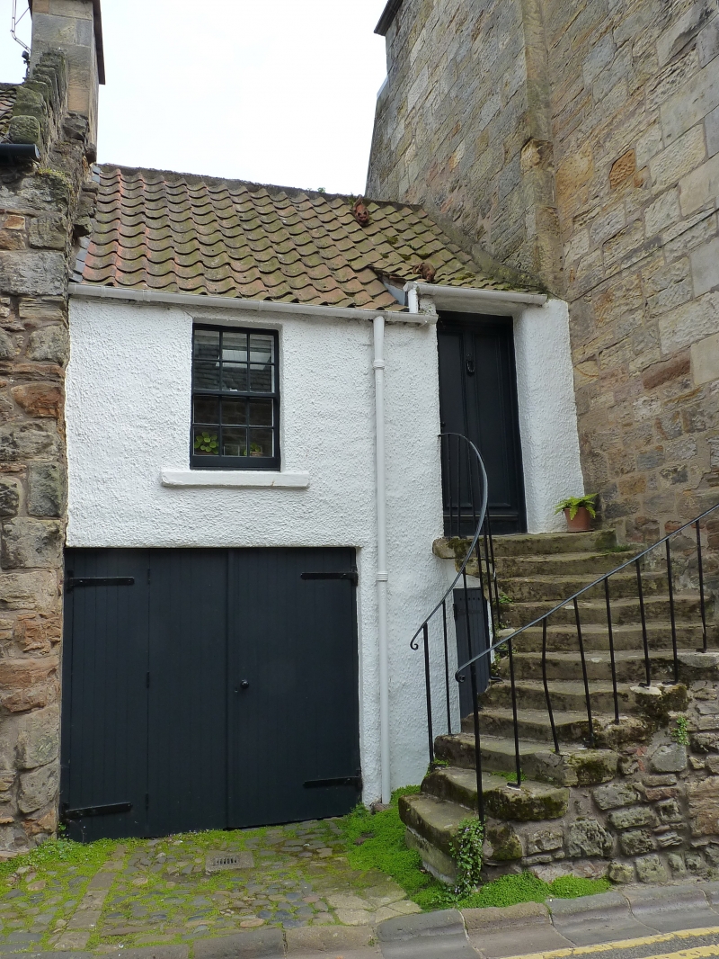
Listing Name: 11 South Castle Street (Joan's House).
Listing Date: 23 February 1971
Category: B
Source: Historic Scotland
Source ID: 386880
Historic Scotland Designation Reference: LB40846
Building Class: Cultural
Also known as: St Andrews, 11 South Castle Street
ID on this website: 200386880
Location: St Andrews
County: Fife
Town: St Andrews
Electoral Ward: St Andrews
Traditional County: Fife
Tagged with: House
18th cent. or earlier. Small 2-storey, whitewashed harl and
pantile forestair; door rises in roof with swept head, pend.
Renovated 1966.
External links are from the relevant listing authority and, where applicable, Wikidata. Wikidata IDs may be related buildings as well as this specific building. If you want to add or update a link, you will need to do so by editing the Wikidata entry.


Other nearby listed buildings
