Approximate Location Map
Large Map »
Latitude: 56.3403 / 56°20'25"N
Longitude: -2.7914 / 2°47'28"W
OS Eastings: 351175
OS Northings: 716717
OS Grid: NO511167
Mapcode National: GBR 2R.4GTW
Mapcode Global: WH7S0.3W1V
Plus Code: 9C8V86R5+4F
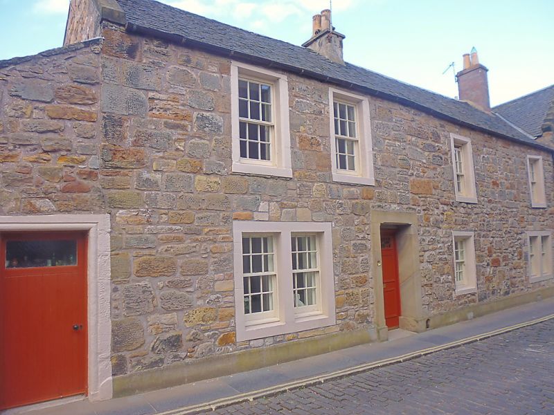
Entry Name: Blacks House, 10 Castle Street, St Andrews
Listing Name: 3, 5 Market Street and 10 South Castle Street
Listing Date: 23 February 1971
Category: B
Source: Historic Scotland
Source ID: 386703
Historic Scotland Designation Reference: LB40725
Building Class: Cultural
Also known as: St Andrews, 10 Castle Street, Blacks House
ID on this website: 200386703
Location: St Andrews
County: Fife
Town: St Andrews
Electoral Ward: St Andrews
Traditional County: Fife
Tagged with: House
17th century, altered. 2-storey, 5-window, rubble and slate; original openings chamfered; painted margins; roll-moulded doorway to No 5, crowstepped gable to Castle Street, modern brick chimney.
External links are from the relevant listing authority and, where applicable, Wikidata. Wikidata IDs may be related buildings as well as this specific building. If you want to add or update a link, you will need to do so by editing the Wikidata entry.


Other nearby listed buildings
