Latitude: 56.3409 / 56°20'27"N
Longitude: -2.8028 / 2°48'10"W
OS Eastings: 350470
OS Northings: 716789
OS Grid: NO504167
Mapcode National: GBR 2R.4D84
Mapcode Global: WH7RZ.XWHD
Plus Code: 9C8V85RW+8V
Entry Name: 22 City Road, St Andrews
Listing Name: 22 City Road.
Listing Date: 23 February 1971
Category: B
Source: Historic Scotland
Source ID: 386988
Historic Scotland Designation Reference: LB40907
Building Class: Cultural
Also known as: St Andrews, 22 City Road
ID on this website: 200386988
Location: St Andrews
County: Fife
Town: St Andrews
Electoral Ward: St Andrews
Traditional County: Fife
Tagged with: Architectural structure
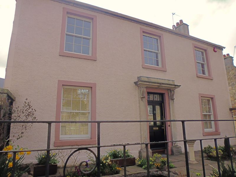
18th cent., remodelled c.1840. 2-storey, 3-window, harl with
margins; slated; consoled doorpiece.
Renovated 1973.
External links are from the relevant listing authority and, where applicable, Wikidata. Wikidata IDs may be related buildings as well as this specific building. If you want to add or update a link, you will need to do so by editing the Wikidata entry.


Other nearby listed buildings