Approximate Location Map
Large Map »
Latitude: 56.2047 / 56°12'17"N
Longitude: -2.7673 / 2°46'2"W
OS Eastings: 352496
OS Northings: 701613
OS Grid: NO524016
Mapcode National: GBR 2S.F26Y
Mapcode Global: WH7SS.G9GQ
Plus Code: 9C8V663M+V3
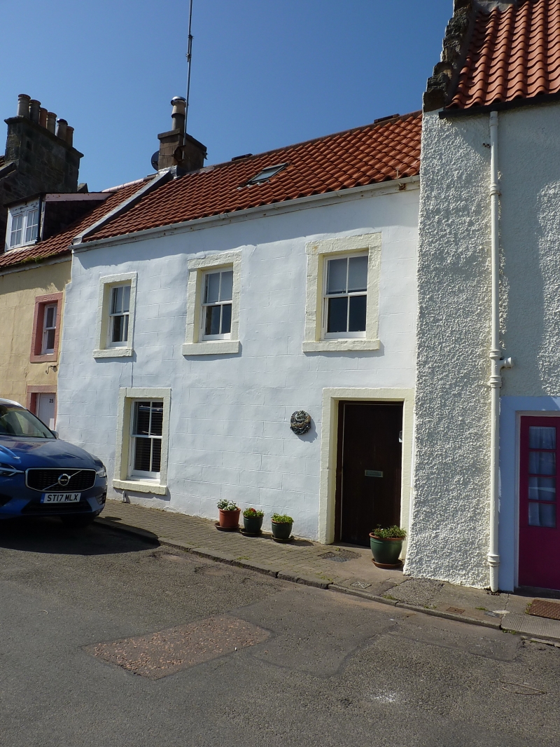
Entry Name: 24 West Shore, St Monance
Listing Name: 24 West Shore
Listing Date: 18 August 1972
Category: B
Source: Historic Scotland
Source ID: 387069
Historic Scotland Designation Reference: LB40980
Building Class: Cultural
Also known as: St Monance, 24 West Shore
ID on this website: 200387069
Location: St Monance
County: Fife
Town: St Monance
Electoral Ward: East Neuk and Landward
Traditional County: Fife
Tagged with: Architectural structure
18th century. 2-storey 3-window at 1st floor, 1-window and door at ground floor, painted stucco with painted margins; roof raised late 19th century, pantiled.
External links are from the relevant listing authority and, where applicable, Wikidata. Wikidata IDs may be related buildings as well as this specific building. If you want to add or update a link, you will need to do so by editing the Wikidata entry.


Other nearby listed buildings
