Approximate Location Map
Large Map »
Latitude: 56.1242 / 56°7'27"N
Longitude: -3.9475 / 3°56'51"W
OS Eastings: 279030
OS Northings: 694095
OS Grid: NS790940
Mapcode National: GBR 1C.L156
Mapcode Global: WH4P6.BBGF
Plus Code: 9C8R43F2+MX
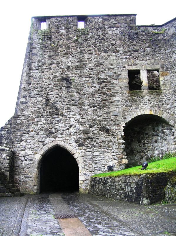
Entry Name: Stirling Castle the Mint (14th Century)
Listing Date: 4 November 1965
Category: A
Source: Historic Scotland
Source ID: 387236
Historic Scotland Designation Reference: LB41141
Building Class: Cultural
ID on this website: 200387236
Location: Stirling
County: Stirling
Town: Stirling
Electoral Ward: Stirling North
Traditional County: Stirlingshire
Tagged with: Architectural structure
14th century (construction of N gateway referred to in 1381)
15th century W extension, further alterations 1512 and 17th
century. 3-storey rubble-built with vaulted transe.
Scheduled Ancient Monument, No 90291.
External links are from the relevant listing authority and, where applicable, Wikidata. Wikidata IDs may be related buildings as well as this specific building. If you want to add or update a link, you will need to do so by editing the Wikidata entry.


Other nearby listed buildings
