Approximate Location Map
Large Map »
Latitude: 56.1168 / 56°7'0"N
Longitude: -3.9387 / 3°56'19"W
OS Eastings: 279556
OS Northings: 693250
OS Grid: NS795932
Mapcode National: GBR 1C.LP3H
Mapcode Global: WH4P6.GJN5
Plus Code: 9C8R4386+PG
Entry Name: 7 Allan Park, Stirling
Listing Name: Allan Park 1-9 (E. Side) (Odd Nos.)
Listing Date: 4 November 1965
Category: B
Source: Historic Scotland
Source ID: 387303
Historic Scotland Designation Reference: LB41191
Building Class: Cultural
Also known as: Stirling, 7 Allan Park
ID on this website: 200387303
Location: Stirling
County: Stirling
Town: Stirling
Electoral Ward: Stirling West
Traditional County: Stirlingshire
Tagged with: House
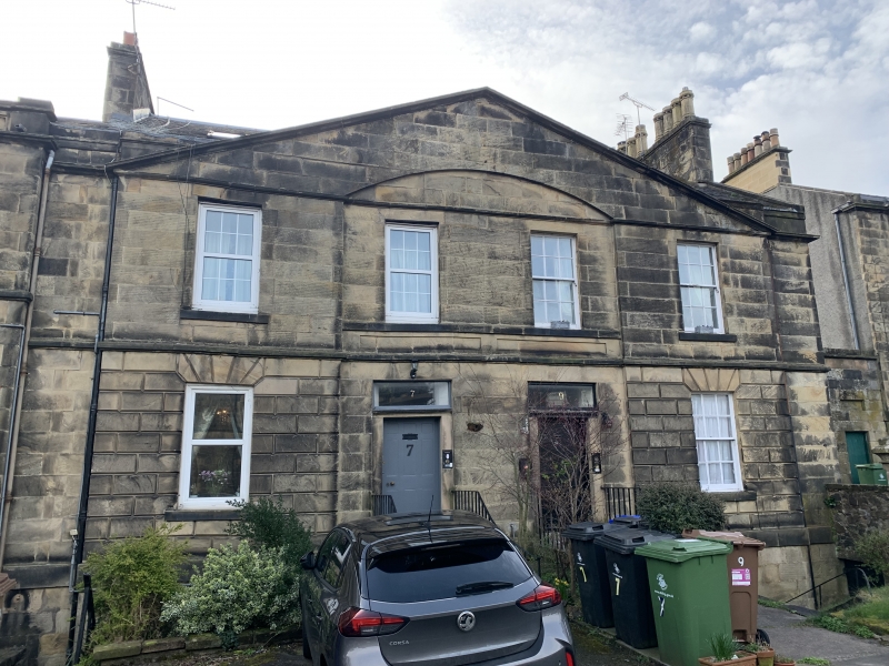
Early 19th century. 2-storey and basement ashlar classic, with segmental arched features, 4-window pedimented semi-detached unit + 2-window single house + 4-window pedimented semi-detached unit ground floor part rusticated, 2 fanlight doorpieces at no 1, 3; railed steps. Slated roof.
Tunnel linking front to rear garden adjoins gable of No. 9.
External links are from the relevant listing authority and, where applicable, Wikidata. Wikidata IDs may be related buildings as well as this specific building. If you want to add or update a link, you will need to do so by editing the Wikidata entry.


Other nearby listed buildings
