Latitude: 56.1165 / 56°6'59"N
Longitude: -3.9388 / 3°56'19"W
OS Eastings: 279548
OS Northings: 693226
OS Grid: NS795932
Mapcode National: GBR 1C.LP2G
Mapcode Global: WH4P6.GJLB
Plus Code: 9C8R4386+JF
Entry Name: 11 And 11A Allan Park Road, Stirling
Listing Name: Allan Park 11, 11A (E. Side)
Listing Date: 4 November 1965
Category: B
Source: Historic Scotland
Source ID: 387305
Historic Scotland Designation Reference: LB41192
Building Class: Cultural
Also known as: Stirling, 11 And 11a Allan Park Road
ID on this website: 200387305
Location: Stirling
County: Stirling
Town: Stirling
Electoral Ward: Stirling West
Traditional County: Stirlingshire
Tagged with: House
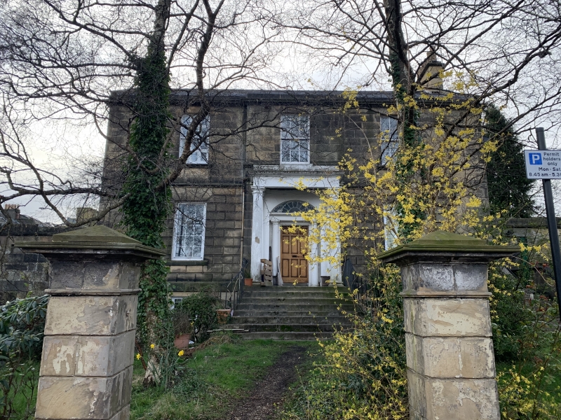
Early 19th century. 2-storey and basement 3-window ashlar:
slightly advanced centre bay with Roman doric columned
fanlight doorpiece, railed steps: ground floor part
rusticated, main cornice and blocking course. Slated roof.
External links are from the relevant listing authority and, where applicable, Wikidata. Wikidata IDs may be related buildings as well as this specific building. If you want to add or update a link, you will need to do so by editing the Wikidata entry.


Other nearby listed buildings