Latitude: 56.1167 / 56°7'0"N
Longitude: -3.9396 / 3°56'22"W
OS Eastings: 279502
OS Northings: 693247
OS Grid: NS795932
Mapcode National: GBR 1C.LNXR
Mapcode Global: WH4P6.GJ76
Plus Code: 9C8R4386+M5
Entry Name: 10 Allan Park, Stirling
Listing Name: Allan Park 8, 10 (W. Side)
Listing Date: 4 November 1965
Category: B
Source: Historic Scotland
Source ID: 387315
Historic Scotland Designation Reference: LB41198
Building Class: Cultural
Also known as: Stirling, 10 Allan Park
ID on this website: 200387315
Location: Stirling
County: Stirling
Town: Stirling
Electoral Ward: Stirling West
Traditional County: Stirlingshire
Tagged with: House
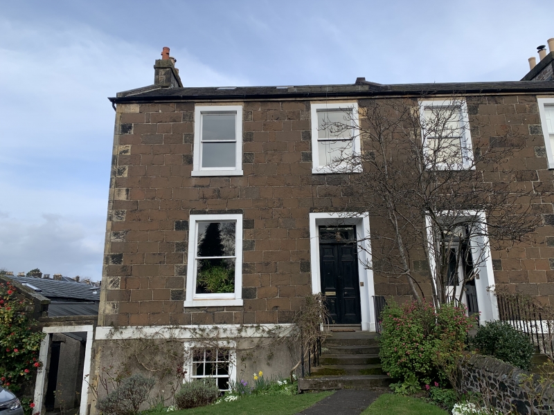
Thomas Traquair. Early 19th century. Plain whin ashlar,
semi-detached, 2-storey and basement 4-window with painted
margins; cavetto splay to doors. Slated roof.
External links are from the relevant listing authority and, where applicable, Wikidata. Wikidata IDs may be related buildings as well as this specific building. If you want to add or update a link, you will need to do so by editing the Wikidata entry.


Other nearby listed buildings