Approximate Location Map
Large Map »
Latitude: 56.9602 / 56°57'36"N
Longitude: -2.2017 / 2°12'6"W
OS Eastings: 387830
OS Northings: 785462
OS Grid: NO878854
Mapcode National: GBR XL.BSTB
Mapcode Global: WH9RN.4BT1
Plus Code: 9C8VXQ6X+38
Entry Name: Stonehaven Harbour
Listing Name: Harbour of Stonehaven
Listing Date: 18 August 1972
Category: B
Source: Historic Scotland
Source ID: 387943
Historic Scotland Designation Reference: LB41625
Building Class: Cultural
ID on this website: 200387943
Location: Stonehaven
County: Aberdeenshire
Town: Stonehaven
Electoral Ward: Stonehaven and Lower Deeside
Traditional County: Kincardineshire
Tagged with: Harbour
16th century and later, extended 1825-35, Robert Stevenson, and later, repaired 1970s. Harbour comprising middle, inner and outer basins, and 4 piers (Net Pier or Old Pier, Fish Jetty, both before 1823, South Pier, and Breakwater after 1867). Net Pier has vertically coursed masonry, South Pier with masonry in inclined courses. High coped rubble parapets to South Pier, which together with Fish Jetty forms the inner basin. Original rubble works modified with sheet piling.
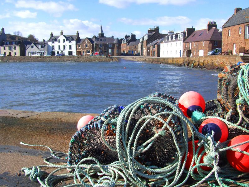
Stonehaven Harbour, situated in a natural bay between the River Carron and Downie Point, has long been the focal point of the town. Its special interest derives from the fine stonework, structure and plan as well as the historical significance of its role in the development of Stonehaven from small fishing port to flourishing burgh. The New Statistical Account tells of the importance of the fishing industry when 'herring barrels used to line the whole length of the High Street'. The town is said to have been named after the large rock called Craig-ma-cair, which sat in the bay. It was quarried and finally blown up in 1826 as part of Robert Stevenson's improvements. The original north pier, built in the 16th century, was twice destroyed and subsequently rebuilt in 1688 by the 9th Earl Marischal. In 1658 Richard Franck had described the harbour thus 'Now at the foot of this pavement there's a small harbour which they call Steenhive, but I have taken the liberty to call it Stinking hive, because it is so unsavoury, which serves only for pirates and pickeroons '' A second pier, built in 1700, formed the north harbour. Although hugely important for the import and export of goods to and from Stonehaven during the 18th century, the harbour is now (early 21st century) predominantly used for recreation. During the herring boom of the 1890's, the harbour supported nearly 200 fishing boats.
External links are from the relevant listing authority and, where applicable, Wikidata. Wikidata IDs may be related buildings as well as this specific building. If you want to add or update a link, you will need to do so by editing the Wikidata entry.


Other nearby listed buildings
