Latitude: 55.9448 / 55°56'41"N
Longitude: -3.1954 / 3°11'43"W
OS Eastings: 325436
OS Northings: 673059
OS Grid: NT254730
Mapcode National: GBR 8NJ.7G
Mapcode Global: WH6SL.WVK1
Plus Code: 9C7RWRV3+WR
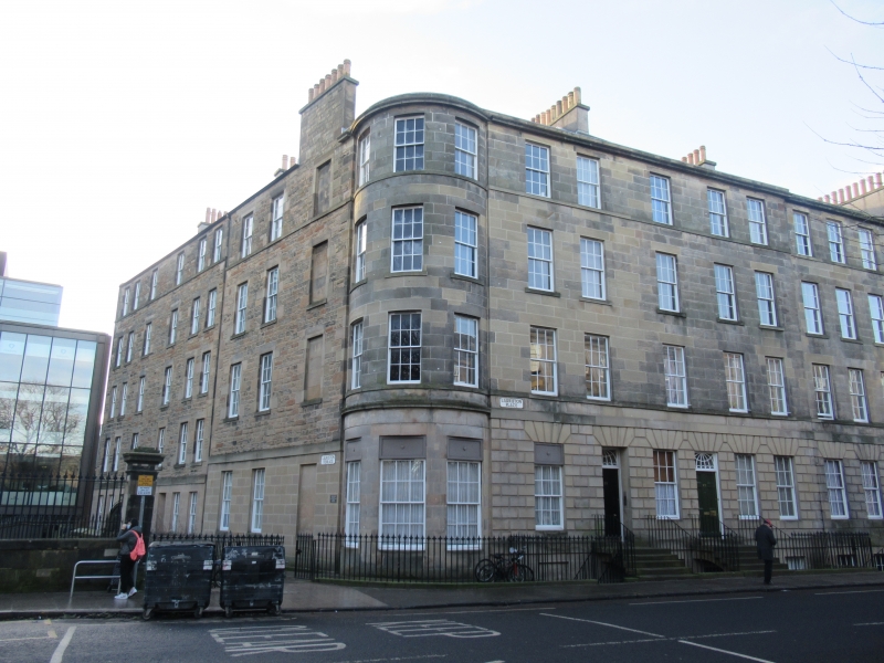
Entry Name: 21-25 Lauriston Place, Edinburgh
Listing Name: 21-35 (Odd Nos) Lauriston Place Including Boundary Walls and Railings
Listing Date: 23 March 2000
Category: B
Source: Historic Scotland
Source ID: 394414
Historic Scotland Designation Reference: LB47034
Building Class: Cultural
Also known as: Edinburgh, 21 - 25 Lauriston Place
ID on this website: 200394414
Location: Edinburgh
County: Edinburgh
Electoral Ward: City Centre
Traditional County: Midlothian
Tagged with: Townhouse
External links are from the relevant listing authority and, where applicable, Wikidata. Wikidata IDs may be related buildings as well as this specific building. If you want to add or update a link, you will need to do so by editing the Wikidata entry.


Other nearby listed buildings