Approximate Location Map
Large Map »
Latitude: 56.7124 / 56°42'44"N
Longitude: -3.7265 / 3°43'35"W
OS Eastings: 294413
OS Northings: 759182
OS Grid: NN944591
Mapcode National: GBR KB5Z.FQ1
Mapcode Global: WH5MJ.QKP2
Plus Code: 9C8RP76F+WC
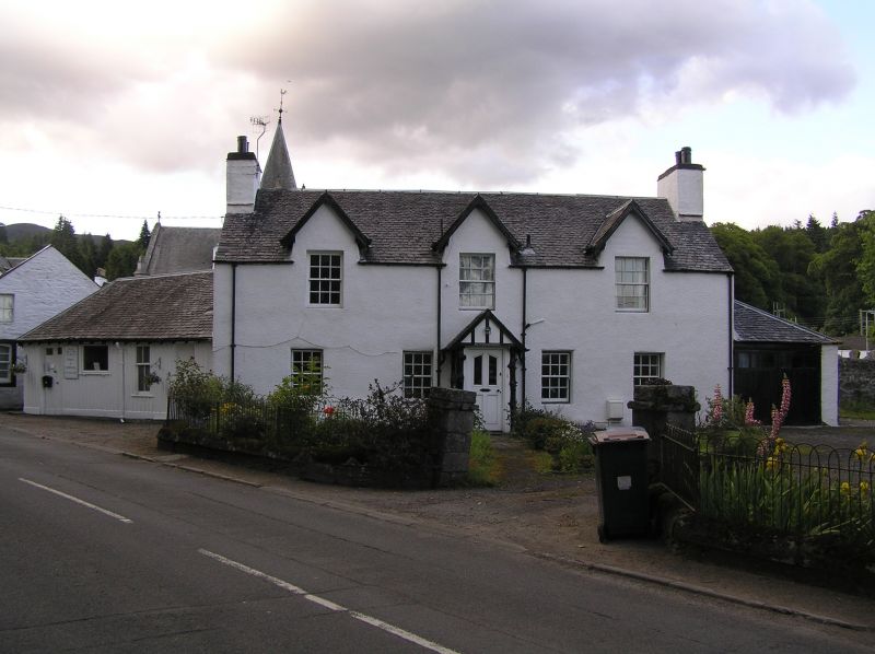
Entry Name: Blairmount, 8 Kirkmichael Road, Moulin
Listing Name: Moulin, Kirkmichael Road, Blairmount with Gatepiers, Boundary Walls and Railings
Listing Date: 20 December 2000
Category: C
Source: Historic Scotland
Source ID: 394886
Historic Scotland Designation Reference: LB47529
Building Class: Cultural
ID on this website: 200394886
Location: Pitlochry
County: Perth and Kinross
Electoral Ward: Highland
Traditional County: Perthshire
Tagged with: Architectural structure
External links are from the relevant listing authority and, where applicable, Wikidata. Wikidata IDs may be related buildings as well as this specific building. If you want to add or update a link, you will need to do so by editing the Wikidata entry.


Other nearby listed buildings
