Approximate Location Map
Large Map »
Latitude: 58.2116 / 58°12'41"N
Longitude: -6.3863 / 6°23'10"W
OS Eastings: 142465
OS Northings: 933141
OS Grid: NB424331
Mapcode National: GBR B7M0.TV1
Mapcode Global: WGY2Y.WV3T
Plus Code: 9CCM6J67+JF
Entry Name: 67 Keith Street
Listing Name: 67 Keith Street Including Boundary Wall and Railings
Listing Date: 9 February 2007
Category: C
Source: Historic Scotland
Source ID: 399327
Historic Scotland Designation Reference: LB50798
Building Class: Cultural
ID on this website: 200399327
Location: Stornoway
County: Na h-Eileanan Siar
Town: Stornoway
Electoral Ward: Steòrnabhagh a Deas
Traditional County: Ross-shire
Tagged with: Architectural structure
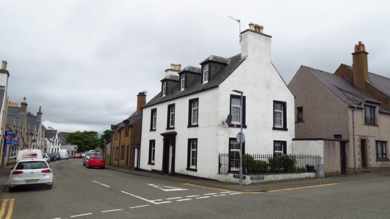
Probably late 18th to early 19th century. Imposing tall 2-storey and attic, 3-bay, rectangular-plan house with pedimented and pilastered doorpiece and deep-set openings, on prominent corner site of principal Stornoway street. Harled with stone margins and cills.
FURTHER DESCRIPTION: symmetrical entrance elevation to W with centre door, windows in flanking bays and regular fenestration to 1st floor, 3 regularly-disposed piended dormer windows above. Gabled elevation to S (Scotland Street) with 2 windows to each floor and dominant gablehead stack.
Replacement glazing throughout. Grey slates. Coped harled stacks with some cans
BOUNDARY WALL AND RAILINGS: low coped and harled boundary wall with inset decorative cast iron railings to S.
This well-proportioned house is a rare survival, retaining much of its original character as a prosperous early 19th century dwelling close to the heart of the burgh of Stornoway. Prominently located at the junction of Keith Street and Scotland Street, with the Female Industrial School (listed separately at category B) sited at the diagonally opposite corner, the building retains streetscape value despite the loss of traditional glazing and front door.
The Statistical Account of 1799 notes the existence of 67 slated houses in the burgh, 26 of which had been constructed since 1786. The lack of evidence of any thackstanes may point to this being one of those early slated houses. Certainly the town was expanding in an easterly direction from the late 18th century onwards. The Burgh Survey notes that 'The principal streets follow a north-to-south and east-to-west grid pattern and comprise Keith Street, Lewis Street, Matheson Road, Francis Street, Church Street and Scotland Street. This area is largely residential and contains some fine examples of period housing'. Keith Street is named for George and James Keith who fled to the continent after the 1719 Jacobite rising.
External links are from the relevant listing authority and, where applicable, Wikidata. Wikidata IDs may be related buildings as well as this specific building. If you want to add or update a link, you will need to do so by editing the Wikidata entry.


Other nearby listed buildings
