Approximate Location Map
Large Map »
Latitude: 57.2278 / 57°13'40"N
Longitude: -5.6648 / 5°39'53"W
OS Eastings: 178889
OS Northings: 821183
OS Grid: NG788211
Mapcode National: GBR D9DM.80C
Mapcode Global: WH0BD.YLNF
Plus Code: 9C9P68HP+43
Entry Name: Kylerhea Slipway (Kylerhea Ferry)
Listing Name: Kylerhea Slipway (Kylerhea Ferry)
Listing Date: 14 January 2010
Category: B
Source: Historic Scotland
Source ID: 400303
Historic Scotland Designation Reference: LB51413
Building Class: Cultural
ID on this website: 200400303
Location: Strath
County: Highland
Electoral Ward: Eilean á Chèo
Parish: Strath
Tagged with: Architectural structure
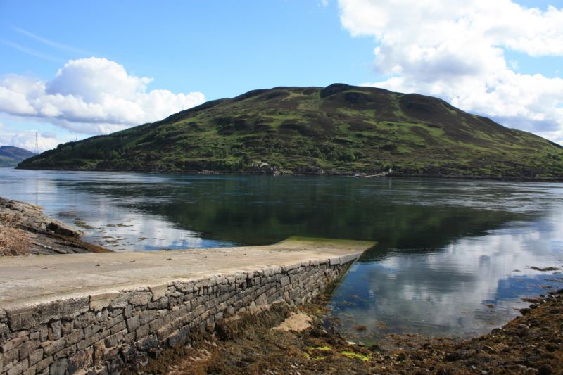
Thomas Telford, 1821. Dressed whinstone slipway serving the Kylerhea Ferry and former cattle drove. Counterpart slipway located on the opposite bank of the Kyle Rhea at Glenelg (see separate listing).
Large dressed whinstone blocks laid in courses, shelving into water. Paved with stone setts, currently covered with concrete screed (2009).
Coped rubble approach road retaining wall adjoining slipway to S.
Part of a B-Group including 'Glenelg Slipway (Kylerhea Ferry)', 'Kylerhea Ferry Old Ferry Inn' situated to the N of the Glenelg slipway and 'Kylerhea Old Inn' situated 200 metres to the S of the Kylerhea slipway (see separate listings).
Built by world-renowned engineer Thomas Telford and his associates, this slipway of 1821, along with its counterpart slipway at Glenelg (see separate listing), marks the shortest and most most historically significant crossing-place between mainland Scotland and the Isle of Skye. This was the primary cattle droving route out of the islands. While the Glenelg slipway incorporates a cattle droving ramp into its design, it is likely that a natural cut in the rock located a short distance to the S of the Kylerhea slipway, was utilised to funnel cattle into the water on this side. A passenger ferry service is also recorded as operating here in the 17th century. The crossing was utilised as part of General Wade's military road system in the mid 18th century.
Droving was critical to the economy of the western Highlands and the outer islands between the 16th and late 19th centuries with as many as 8000 cattle swimming across the Kyle Rhea each year. In 1811, Thomas Telford noted that Kylerhea would always remain the usual ferry for the Black Cattle of Skye and later estimated that £6000 was saved each year by using the ferry crossing as a drove road as it was the quickest route south. 300 cattle could be taken across in a few hours, funnelled in and out of the water before being driven long distances to market, notably at Crieff, Falkirk and Linlithgow. The arrival of sheep and the railway to the West Highlands in the later 19th century saw the demise of droving as a way of life.
The slipways also serve as termini of the mountainous approach roads which wind their way to and from the Kyle Rhea ferry. Originally built circa 1750 under Major Caulfield's direction for General Wade's military road system, the road was subsequently developed in 1805 by the Highland Roads Commission, using substantial buttressed retaining walls, to serve as the principle route into and across Skye.
The slipway forms part of a wider 'B-group' including its counterpart 'Glenelg Slipway', the former 'Kylerhea Old Inn' 200m to the south of the Kylerhea slipway, and the former 'Old Ferry Inn' located 200m to the N of Glenelg slipway (see separate listings). The two former Inns (circa 1800) are comparable in scale and massing, with the 'Kylerhea Old Inn' understood to have been built by eminent Scottish architect, James Gillespie Graham. A simple, single-storey, 3-bay cottage of 1926 is located just N of the Kylerhea slipway which may have housed the ferryman. A swivel-deck ferry boat continues to run (2009) between April and October, serving the local community and tourist trade.
External links are from the relevant listing authority and, where applicable, Wikidata. Wikidata IDs may be related buildings as well as this specific building. If you want to add or update a link, you will need to do so by editing the Wikidata entry.


Other nearby listed buildings
