Approximate Location Map
Large Map »
Latitude: 53.1849 / 53°11'5"N
Longitude: -3.0256 / 3°1'32"W
OS Eastings: 331561
OS Northings: 365805
OS Grid: SJ315658
Mapcode National: GBR 74.39KC
Mapcode Global: WH88C.H6GP
Plus Code: 9C5R5XMF+XQ
Entry Name: Kentigern
Listing Date: 2 July 1962
Last Amended: 16 November 1994
Grade: II
Source: Cadw
Source ID: 20
Building Class: Domestic
ID on this website: 300000020
Location: On the street line.
County: Flintshire
Community: Hawarden (Penarlâg)
Community: Hawarden
Built-Up Area: Sandycroft
Traditional County: Flintshire
Tagged with: House
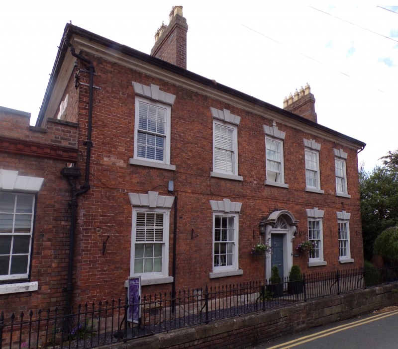
Built in 1767 for John Boydell, an engraver and print seller, who became Lord Mayor of London in 1780. The Boydells were the agents to the Glynne family for several generations.
2-storey mid-Georgian house of red brick with stone detailing under a shallow-pitched slate roof. Later stacks between bays 1 and 2 and at N gable end. Simply moulded stone eaves. Symmetrical facade in Flemish bond on a stone plinth. Entrance with arched canopy hood supported by scrolled brackets. Recessed 6-panel door with fielded upper panels. 12 pane, almost flush sash windows with rusticated voussoirs and projecting keys and cills. Contemporary Sun Assurance plaque under eaves.
Early C19 stuccoed range to rear, and similar brick extension to N with mono-pitch roof. Dentilated eaves and windows with cambered heads. Abutting this to the N a tall brick wall enclosing a brick-floored service court with L-shaped range of single-storey offices ranged around the E and N sides, partly rebuilt C20. Tall, mid-C19 wall enclosing L-shaped garden, with stone capping. Railed terrace to street front of brick and stone with stepped access to R.
Full height well stair with turned, painted balusters and swept rail. Depressed-arched opening (now reduced) between hall and stair-well. Moulded, chamfered beam with arrow stops in rear R-hand room, formerly the kitchen. This may relate to an earlier (C16) core, but is most likely reused.
External links are from the relevant listing authority and, where applicable, Wikidata. Wikidata IDs may be related buildings as well as this specific building. If you want to add or update a link, you will need to do so by editing the Wikidata entry.


Other nearby listed buildings
