Approximate Location Map
Large Map »
Latitude: 53.2735 / 53°16'24"N
Longitude: -3.2221 / 3°13'19"W
OS Eastings: 318599
OS Northings: 375860
OS Grid: SJ185758
Mapcode National: GBR 5ZYL.68
Mapcode Global: WH76K.GZWC
Plus Code: 9C5R7QFH+95
Entry Name: The Red Lion PH
Listing Date: 26 July 1951
Last Amended: 19 August 1991
Grade: II
Source: Cadw
Source ID: 448
Building Class: Commercial
Also known as: Red Lion, Holywell
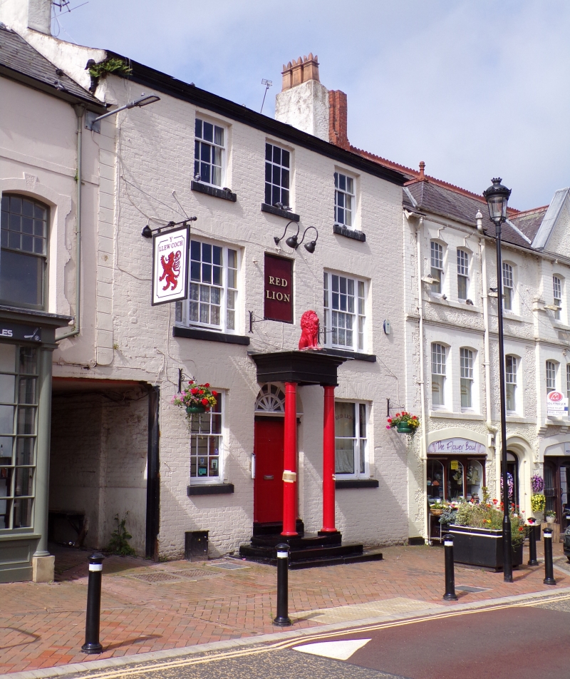
The Red Lion P.H. High Street
ID on this website: 300000448
Location: Set into the line of street frontages near facade of former Town Hall.
County: Flintshire
Community: Holywell (Treffynnon)
Community: Holywell
Built-Up Area: Holywell
Traditional County: Flintshire
Tagged with: Pub
Earlier C19 (shown on 1833 map); late-Georgian.
3-storey, 2-window painted brick front including painted-on quoins and plinth. Slate roof, moulded eaves band and roughcast end chimney stacks. 9-pane sash windows to 2nd floor flanking blocked central opening; small pane tripartite windows to 1st floor flanking PH sign. Similar size window to ground floor right with glazing bars removed; 12-pane sash to left. Steps up to central porch with replaced timber columns and radiating fanlight over 6-panel door with flanking Doric columns. Square-headed former carriage entry to left, extending beneath part of No 30 - this was the mail coach's entrance to the former Old Post Office Place. At rear, later cross range curves back and includes large chimney stack on the gable end. Slightly lower 1-window range beyond.
Listed for its preserved town centre late-Georgian front.
Group value.
External links are from the relevant listing authority and, where applicable, Wikidata. Wikidata IDs may be related buildings as well as this specific building. If you want to add or update a link, you will need to do so by editing the Wikidata entry.


Other nearby listed buildings
