Approximate Location Map
Large Map »
Latitude: 53.0441 / 53°2'38"N
Longitude: -2.9931 / 2°59'35"W
OS Eastings: 333515
OS Northings: 350113
OS Grid: SJ335501
Mapcode National: GBR 75.DCFG
Mapcode Global: WH88Y.ZRW5
Plus Code: 9C5V22V4+MQ
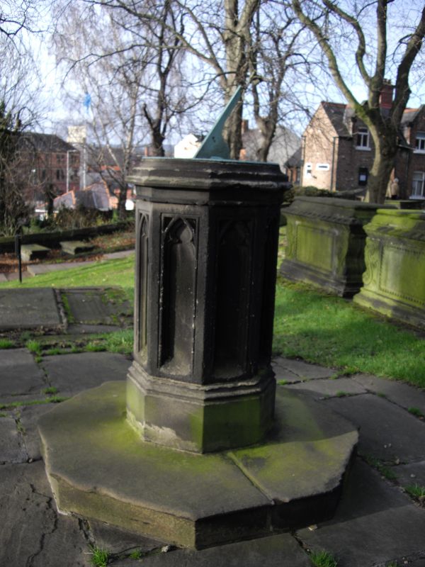
Entry Name: Sundial to West of Church of St Giles
Listing Date: 16 June 1980
Last Amended: 31 January 1994
Grade: II
Source: Cadw
Source ID: 1771
Building Class: Gardens, Parks and Urban Spaces
ID on this website: 300001771
Location: West of the tower of Saint Giles' Church.
County: Wrexham
Community: Offa
Community: Offa
Built-Up Area: Wrexham
Traditional County: Denbighshire
Tagged with: Sundial
Sundial, dated 1809 and presented by Edward Ravenscroft.
Stone. High octagonal plinth with traceried recessed panels and copper plate inscribed with numerals etc. Dated on the stonework, but badly worn.
Group value.
External links are from the relevant listing authority and, where applicable, Wikidata. Wikidata IDs may be related buildings as well as this specific building. If you want to add or update a link, you will need to do so by editing the Wikidata entry.


Other nearby listed buildings
