History in Structure

Railings, Gates and Garden Walls of No. 23 (Chapel House)

A Grade II Listed Building in Monmouth, Monmouthshire

More Photos »
Approximate Location Map
Large Map »

Coordinates

Latitude: 51.8153 / 51°48'55"N

Longitude: -2.7132 / 2°42'47"W

OS Eastings: 350931

OS Northings: 213208

OS Grid: SO509132

Mapcode National: GBR FL.WTWC

Mapcode Global: VH86T.XMHQ

Plus Code: 9C3VR78P+4P

Entry Name: Railings, Gates and Garden Walls of No. 23 (Chapel House)

Listing Date: 15 August 1974

Last Amended: 10 August 2005

Grade: II

Source: Cadw

Source ID: 2310

Building Class: Domestic

ID on this website: 300002310

Location: On the principal road leading north from Monmouth centre set between Monk Street and Hereford Road.

County: Monmouthshire

Town: Monmouth

Community: Monmouth (Trefynwy)

Community: Monmouth

Built-Up Area: Monmouth

Traditional County: Monmouthshire

Tagged with: Railing

Find accommodation in
Monmouth

History

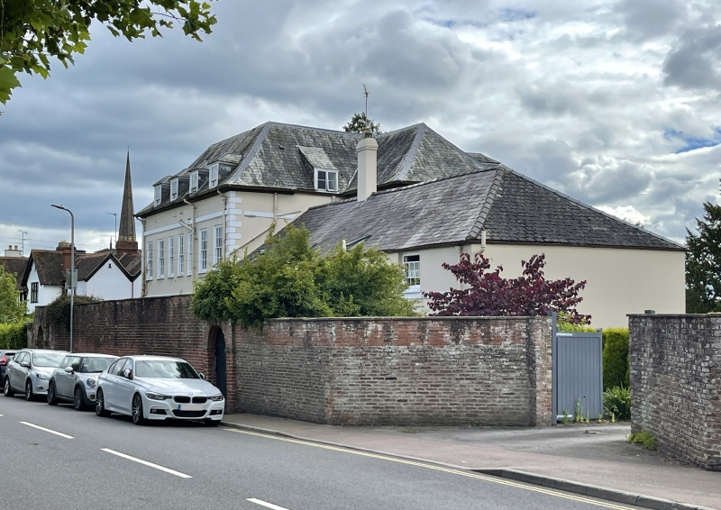
Brick walls probably contemporary with the house c1720, with the iron railings and gates probably added as part of the c1800 improvements.

Exterior

Red brick walls with wrought iron railings and gates in front of the main entrance. Railings on dwarf walls, double gates with dog bars swept up to the sides. This is flanked by high garden walls of red brick on both sides. Walls are stepped up convexly from rusticated piers adjoining railings. Arched doorways on each side.

Reasons for Listing

Included for its special interest as a fine adjunct to an important Georgian house on the road leading north out of Monmouth town centre.

External Links

External links are from the relevant listing authority and, where applicable, Wikidata. Wikidata IDs may be related buildings as well as this specific building. If you want to add or update a link, you will need to do so by editing the Wikidata entry.

Recommended Books

Other nearby listed buildings

  • II* Chapel House
    On the principal road leading north from Monmouth centre set between Monk Street and Hereford Road.
  • II Parade House
    On the principal road leading north from Monmouth centre set between Monk Street and Hereford Road.
  • II 21, Monk Street
    On the principal road which runs north-south on the east side of Monmouth town centre.
  • II 19, Monk Street
    On the principal road which runs north-south on the east side of Monmouth town centre.
  • II NO.20 Monk Street, Gwent
    On the principal road which runs north-south on the east side of Monmouth town centre.
  • II 17, Monk Street
    On the principal road which runs north-south on the east side of Monmouth town centre.
  • II 18, Monk Street
    On the principal road which runs north-south on the east side of Monmouth town centre.
  • II 15, Monk Street
    On the principal road which runs north-south on the east side of Monmouth town centre.

BritishListedBuildings.co.uk is an independent online resource and is not associated with any government department. All government data published here is used under licence. Please do not contact BritishListedBuildings.co.uk for any queries related to any individual listed building, planning permission related to listed buildings or the listing process itself.

British Listed Buildings is a Good Stuff website.