Approximate Location Map
Large Map »
Latitude: 51.7201 / 51°43'12"N
Longitude: -3.0175 / 3°1'3"W
OS Eastings: 329806
OS Northings: 202869
OS Grid: SO298028
Mapcode National: GBR J4.2ZMP
Mapcode Global: VH79S.N135
Plus Code: 9C3RPXCJ+3X
Entry Name: Troed-y-Rhiw
Listing Date: 4 March 1952
Last Amended: 18 July 2001
Grade: II
Source: Cadw
Source ID: 2622
Building Class: Domestic
ID on this website: 300002622
Location: About 900m south west of the Church of St. Illtyd.
County: Monmouthshire
Town: Pontypool
Community: Goetre Fawr
Community: Goetre Fawr
Locality: Mamhilad
Traditional County: Monmouthshire
Tagged with: Building
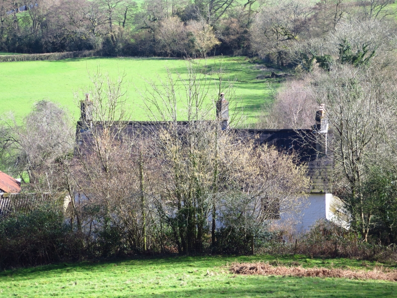
This is a c1600 two cell end entry house which had an additional room added with a cross-passage entry, probably before 1650. The house was refurbished in the mid C19 and given a much more uniform appearance on the south elevation. The original cross-passage entry is now blocked on the north. The farm became a part of the Pontypool Park estate in the early/mid C19 when it was altered and the chimneys may have been changed to the characteristic estate ones at this time. It was purchased from the estate at the sale in 1926 by the father of the present owner and has been little changed since, apart from the usual modernisation.
The house is constructed of painted local sandstone rubble with Welsh slate roofs. It is a two storey two cell end entry house with an additional room at the west end. The entrance gable has a single storey lean-to probably added in the early C20. Porch to door, two garret windows in the gable on either side of stack, single chimney with diamond set top. The south front (left) has three bays, with the later addition set back at the far end. The original part has a gabled porch with a part glazed door flanked by 3-light casements in elliptical heads. Two similar 2-light casements above. This is all a mid C19 attempt to give the house a symmetrical appearance. The extension to the left has a 2-light casement on either floor, but not in line, the upper one being to the left. Steeply pitched roof with another single flue stack at the division between the two parts and a four flue one at the added kitchen gable end, all with diamond set flues. Plain bargeboards to the gables. The gable to the far end has a single storey lean-to with slate roof extended in the C20 in corrugated sheeting. The wall above is blind but there are some indications of an opening. The rear long wall has smaller openings which may equate to C17 ones. A 2-light casement on the ground floor and two above, all small paned, in the older part and the doorway to the cross passage now converted to a window in the addition, large casement above.
The original part of the house is still divided by an oak post-and-panel partition which is well preserved and includes a doorway with a four-centred head. The main room has beams with wide chamfers, bar and runout stops. The fireplace in the entrance wall has been altered.
Spiral stair of solid oak treads rises to the attic. The roof is three bays with massive principal rafters halved and pegged at the apex, collars, ridge piece, two tiers of purlins and secondary rafters, mostly original. The addition has the evidence for the cross-passage in the mortices but the partition is long gone, as are the kitchen hearths etc. Ceiling beams largely replaced.
Included as a mainly early C17 farmhouse which, despite alteration and enlargement, retains interesting features and much historic character.
External links are from the relevant listing authority and, where applicable, Wikidata. Wikidata IDs may be related buildings as well as this specific building. If you want to add or update a link, you will need to do so by editing the Wikidata entry.


Other nearby listed buildings
