Approximate Location Map
Large Map »
Latitude: 51.8216 / 51°49'17"N
Longitude: -3.0246 / 3°1'28"W
OS Eastings: 329477
OS Northings: 214161
OS Grid: SO294141
Mapcode National: GBR F5.WGC5
Mapcode Global: VH796.JGCX
Plus Code: 9C3RRXCG+J5
Entry Name: Telephone Call-box close to entrance to Linda Vista Gardens
Listing Date: 3 November 1988
Last Amended: 10 November 2005
Grade: II
Source: Cadw
Source ID: 2801
Building Class: Communications
ID on this website: 300002801
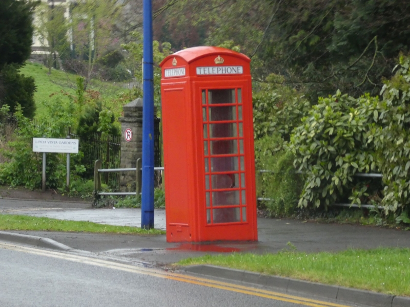
Location: Located towards the roadway on a wide pavement with grassed verges opposite Laundry Place with its back to the road.
County: Monmouthshire
Town: Abergavenny
Community: Abergavenny (Y Fenni)
Community: Abergavenny
Built-Up Area: Abergavenny
Traditional County: Monmouthshire
Tagged with: K6 telephone box
K6 type kiosk to the standard design of Giles Gilbert Scott, architect of London. Design introduced by GPO in 1936, this example probably installed after World War II. Foundry plate: ''Lion Foundry Co Ltd, Kirkintilloch''.
K6 type square kiosk of cast iron construction. Domed roof with four lunettes containing King George VI crowns over red lettered opals and ventilation slits. Raised surrounds to door and sides with marginal glazing bars to horizontal (perspex) glazing. Foundry plate: ''Lion Foundry Co Ltd, Kirkintilloch''.
Included for its special interest as a K6 telephone box in a heritage location, which is located within Abergavenny conservation area.
External links are from the relevant listing authority and, where applicable, Wikidata. Wikidata IDs may be related buildings as well as this specific building. If you want to add or update a link, you will need to do so by editing the Wikidata entry.


Other nearby listed buildings
