Approximate Location Map
Large Map »
Latitude: 51.6723 / 51°40'20"N
Longitude: -4.6986 / 4°41'54"W
OS Eastings: 213497
OS Northings: 200506
OS Grid: SN134005
Mapcode National: GBR GF.7QM6
Mapcode Global: VH2PS.H7XC
Plus Code: 9C3QM8C2+WH
Entry Name: The Sluice including The Hard and The Mayor's Slip
Listing Date: 26 April 1977
Last Amended: 28 March 2002
Grade: II
Source: Cadw
Source ID: 6157
Building Class: Maritime
ID on this website: 300006157
Location: Situated on the S side of the harbour below Crackwell Street.
County: Pembrokeshire
Town: Tenby
Community: Tenby (Dinbych-y-pysgod)
Community: Tenby
Built-Up Area: Tenby
Traditional County: Pembrokeshire
Tagged with: Architectural structure
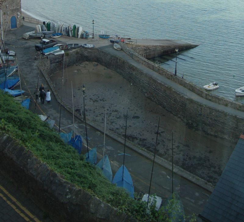
Earlier C17 in origin, almost entirely rebuilt since, the sluice is a stone-walled dock in which sea-water was retained after high tide to be released through sluice gates to scour sand from the main harbour to the N. The landward quay is called the Hard or South Wharf and was reconstructed in 1763. On the E end of the sluice are blocked arches, under Sleeman's Stores (now the Yacht Club). The basin is curved ended at the W, and from here a slip or landing stage runs NE, called the Mayor's Slip, almost entirely rebuilt in concrete in C20.
Stone-lined enclosed tidal basin with opening to N side. Curving in plan, the W end rounded. Rubble masonry apparently of several builds, much repaired. Rough stone copings. The N side quay has a rubble-stone parapet with rough stone coping, the cannon used as a bollard listed in 1977 was not seen. E end has 3 blocked broad arches under the former warehouse known as Sleeman's Stores (listed separately).
Included as part of the structure of Tenby harbour and as an unusual tidal scouring device.
External links are from the relevant listing authority and, where applicable, Wikidata. Wikidata IDs may be related buildings as well as this specific building. If you want to add or update a link, you will need to do so by editing the Wikidata entry.


Other nearby listed buildings
