History in Structure

Bloomfield

A Grade II Listed Building in Narberth, Pembrokeshire

More Photos »
Approximate Location Map
Large Map »

Coordinates

Latitude: 51.8023 / 51°48'8"N

Longitude: -4.7426 / 4°44'33"W

OS Eastings: 211001

OS Northings: 215080

OS Grid: SN110150

Mapcode National: GBR CW.XN93

Mapcode Global: VH2NZ.RY5P

Plus Code: 9C3QR724+WX

Entry Name: Bloomfield

Listing Date: 17 May 1988

Last Amended: 17 May 1988

Grade: II

Source: Cadw

Source ID: 6502

Building Class: Domestic

ID on this website: 300006502

Location: Set in its own grounds at the SE corner of the Community Centre site.

County: Pembrokeshire

Community: Narberth (Arberth)

Community: Narberth

Built-Up Area: Narberth

Traditional County: Pembrokeshire

Tagged with: House

Find accommodation in
Narberth

Exterior

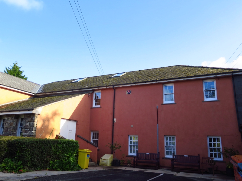
Early C19. Small country house, currently used as a community centre. 2 storey, 3 window. Colourwashed plaster on rubble. New hipped slate roof, end chimneys, plain eaves.
12 pane sash windows to 1st floor, plain reveals, slate sills. Similar to ground floor flanking central doorway.
Slate steps up to imposing portico with open pediment. Dentils. Tuscan columns; half columns flanking round arched doorway with segmental fanlight over 6panel door (upper 4 panels replaced on glass).

Sympathetic modern extensions to flanks and rear. Former walled garden or orchard wall to left. 10ft rubble wall encloses rectangular area of about 1/2 acre; currently tennis court.

Interior

Interior - dog-leg stair with spiral newel, some panelled doors.

External Links

External links are from the relevant listing authority and, where applicable, Wikidata. Wikidata IDs may be related buildings as well as this specific building. If you want to add or update a link, you will need to do so by editing the Wikidata entry.

Recommended Books

Other nearby listed buildings

  • II Bloomfield Terrace
    Set back from the roadside behind a narrow railed forecourt, at the N end of the terrace by the Community Centre.
  • II Bloomfield Terrace
    Set back from the road behind a narrow forecourt at the centre of the terrace by the Community Centre.
  • II NO.21 Northfield Road, Dyfed
    Behind a narrow forecourt on the street line where the road curves some 250 yds from the junction with Spring Gardens.
  • II The Emporium
    Adjoining Hill House and stepped down to the right at the junction with Northfield Road.
  • II Hill House (Chestnut Tree Lodge)
    Prominently sited at the N end of the Higher Street at the confluence of Spring Gardens, Moorfield and Northfield Roads.
  • II Animal Kitchen
    On the street line adjoining the Coach and Horses Inn on the corner with the High Street.
  • II The Coach & Horses Inn
    On the street line at the corner of the High Street with Spring Gardens.
  • II NO.2 High Street, Dyfed
    On the street line adjoining the Coach and Horses Inn on the corner with Spring Gardens.

BritishListedBuildings.co.uk is an independent online resource and is not associated with any government department. All government data published here is used under licence. Please do not contact BritishListedBuildings.co.uk for any queries related to any individual listed building, planning permission related to listed buildings or the listing process itself.

British Listed Buildings is a Good Stuff website.