Approximate Location Map
Large Map »
Latitude: 51.9457 / 51°56'44"N
Longitude: -3.3873 / 3°23'14"W
OS Eastings: 304741
OS Northings: 228377
OS Grid: SO047283
Mapcode National: GBR YP.MNF6
Mapcode Global: VH6BZ.7CM8
Plus Code: 9C3RWJW7+73
Entry Name: NO.27 the Watton, Powys
Listing Date: 16 December 1976
Last Amended: 4 November 2005
Grade: II
Source: Cadw
Source ID: 7109
Building Class: Domestic
ID on this website: 300007109
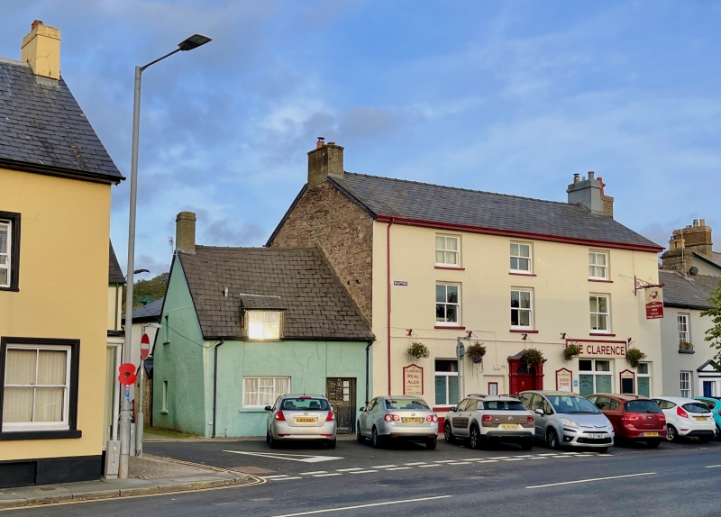
Location: Attached to L of The Clarence Hotel.
County: Powys
Town: Brecon
Community: Brecon (Aberhonddu)
Community: Brecon
Built-Up Area: Brecon
Traditional County: Brecknockshire
Tagged with: Building
C18 probably.
Small house of one storey and attic with steeply pitched slate gabled roof. Roughcast walls. Small catslide dormer with modern window to left hand; a three-light modern casement window below it. Modern door to right hand.
Surviving C18 house with group value with adjacent listed buildings in The Watton.
External links are from the relevant listing authority and, where applicable, Wikidata. Wikidata IDs may be related buildings as well as this specific building. If you want to add or update a link, you will need to do so by editing the Wikidata entry.


Other nearby listed buildings
