History in Structure

Crickhowell Bakery

A Grade II Listed Building in Crickhowell, Powys

More Photos »
Approximate Location Map
Large Map »

Coordinates

Latitude: 51.8591 / 51°51'32"N

Longitude: -3.1373 / 3°8'14"W

OS Eastings: 321773

OS Northings: 218441

OS Grid: SO217184

Mapcode National: GBR F0.T4FH

Mapcode Global: VH6CH.KJSP

Plus Code: 9C3RVV57+J3

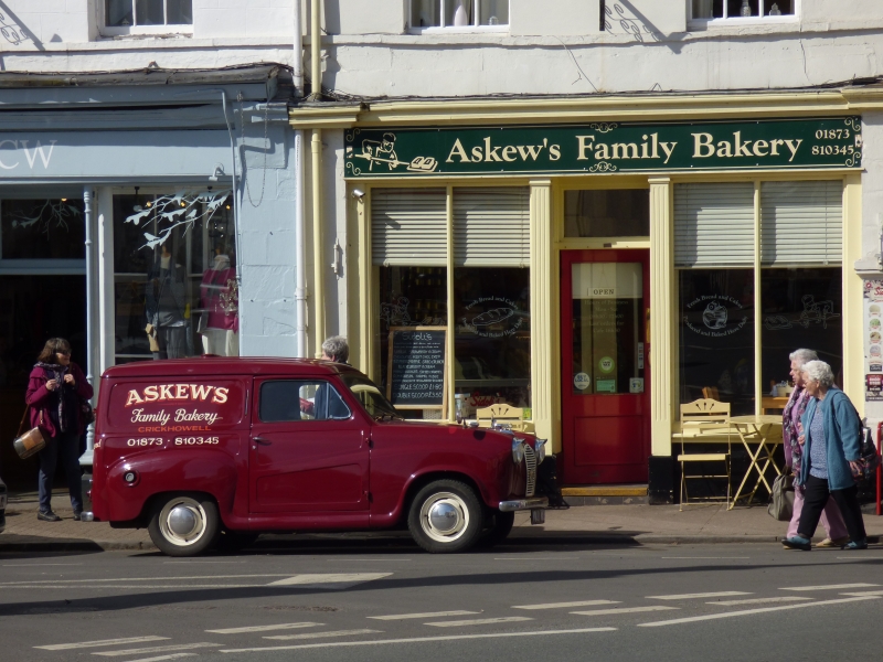
Entry Name: Crickhowell Bakery

Listing Date: 25 September 1986

Last Amended: 25 September 1986

Grade: II

Source: Cadw

Source ID: 7208

Building Class: Commercial

ID on this website: 300007208

Location: At the top of the street with fronts to 'The Square'. A planned terrace adjoining the Town Hall and Uniform with Nos 11 to 13 (consec) to right.

County: Powys

Community: Crickhowell (Crughywel)

Community: Crickhowell

Built-Up Area: Crickhowell

Traditional County: Brecknockshire

Tagged with: Building

Find accommodation in
Llangattock

History

Early to mid C19 (on 1840 Tithe Map).

Exterior

Late Georgian group of paired 3-storey and basement rendered and stuccoed frontages, cement, scribed and roughcast with deep cill bands. Slate roofs, brick and cement render chimney stacks; No 17 retains parapet. Recessed 6- and 12-pane sash windows retained to No 16 and 12-pane to 1st floor of No 17. Shop front preserved to Nos 16 and 17 with blind boxes, moulded cornices, ironwork ventilation band and fluted and foliated mullions to shop windows of No 17; splayed central entrances. Both pairs have dividing advanced ground floor openings with cornices and keystones to semicircular headed arches leading to narrow cross passage.

Reasons for Listing

Group value.

External Links

External links are from the relevant listing authority and, where applicable, Wikidata. Wikidata IDs may be related buildings as well as this specific building. If you want to add or update a link, you will need to do so by editing the Wikidata entry.

Recommended Books

Other nearby listed buildings

  • II Pip's Shop
    At the top of the street with fronts to 'The Square'. A planned terrace adjoining the Town Hall and Uniform with Nos 11 to 13 (consec) to right.
  • II Philip's Hair Studio
    At the top of the street with fronts to 'The Square'. A planned terrace adjoining the Town Hall and Uniform with Nos 11 to 13 (consec) to right.
  • II James Isaac
    At the top of the street with fronts to 'The Square'. A planned terrace adjoining the Town Hall and Uniform with Nos 11 to 13 (consec) to right.
  • II Memorial Fountain
    On an island site at the top of the High Street at the junction with Beaufort Street (A40).
  • II H.J. & D.Webb & Sons
    At the top of the street with fronts to 'The Square' facing down Beaufort Street (A40). At the end of the planned group of frontages; adjoining Cambrian Hotel to right and uniform with terrace to lef
  • II Keith Miles & Co., Estate Agents
    In 'The Square' at the top of the street between the Queen's Coffee Tavern and the Bear Hotel.
  • II McGrath, Pearce & Co., Solicitors
    In 'The Square' at the top of the street between the Queen's Coffee Tavern and the Bear Hotel.
  • II* Town Hall
    Advanced from the contemporary stucco terrace overlooking 'The Square' near the junction with A40.

BritishListedBuildings.co.uk is an independent online resource and is not associated with any government department. All government data published here is used under licence. Please do not contact BritishListedBuildings.co.uk for any queries related to any individual listed building, planning permission related to listed buildings or the listing process itself.

British Listed Buildings is a Good Stuff website.